Osiris4Isis,
excuse me, I was very busy. I'll try to answer your last post from yesterday.
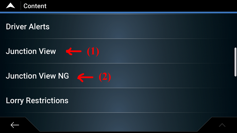
The \content\ map folder containing only the .fjv file. Note the marking (1): "Junction View".
Spoiler: pic
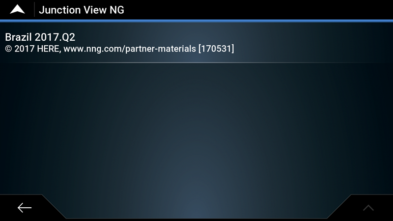
The \content \map folder containing both .FJV and .FJW. Note the marking: (1) "Junction View" and (2) "Junction View NG"
Spoiler: pic
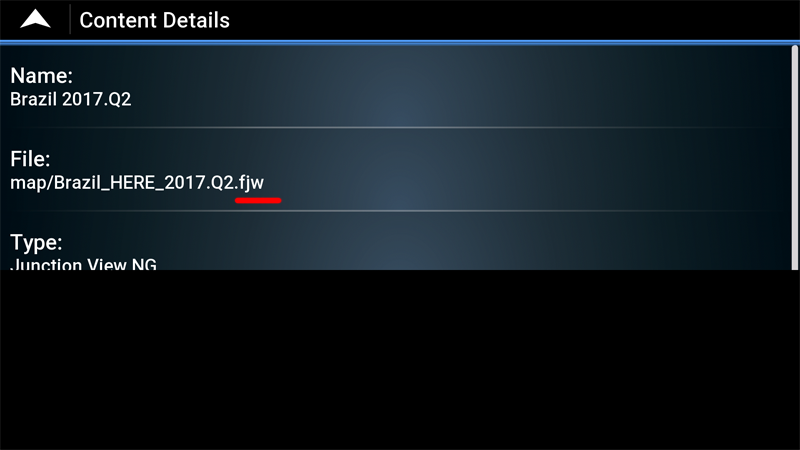
Mark (1) = FJV and (2) = FJW.
Nextgen works with FJV and FJW. Primo works only with FJV. I hope I have helped you.
[]'s
PS: Boki, thanks for the help with the "spoiler".
Welcome guest, is this your first visit? Click the "Create Account" button now to join.
Results 41 to 50 of 57
Thread: FJV & FJW discussions
-
10th November 2017, 02:13 AM #41Master


- Join Date
- Apr 2014
- Location
- Taihape
- Posts
- 180
- Rep Power
- 152
-
11th November 2017, 01:48 AM #42Member


- Join Date
- Oct 2013
- Location
- Brazil
- Posts
- 22
- Rep Power
- 28

-
11th November 2017, 05:33 PM #43

Preliminary decoding of junction data showed that for HERE, the .fjv and .fjw are in similar format (which confirmed that they looks similarly in vector format)
Here are the stats for HERE New Zealand 2016Q4
Spoiler: .
However, TomTom .fjv are quite different, they are indeed raster image
Here are the stats for TomTom New Zealand 2016.12 (I could not find TomTom .fjw files)
Spoiler: .Last edited by osiris4isis; 11th November 2017 at 05:35 PM.
Do not PM me with questions. That's what a forum is for.
-
11th November 2017, 08:31 PM #44Master


- Join Date
- Apr 2014
- Location
- Taihape
- Posts
- 180
- Rep Power
- 152

Great work!
Here is a screenshot of a TomTom fjv as it appears when driving
There doesn't seem to be a landscape option that I can find.
Spoiler: TOO LARGE PIC
Sent from my SM-A310Y using TapatalkLast edited by Boki; 12th November 2017 at 11:27 AM. Reason: SPOILER!
-
11th November 2017, 08:45 PM #45

Thanks for verifying, I was wondering if it would stretch in landscape mode. Ok, so we have something new. The .fjv can store format similar to .fjw (definitely different from raster format) I have to investigate on how to decode that format. But why create two file extensions for storing similar format AND why .fjv always less entries than .fjw (but bigger in size)?
Do not PM me with questions. That's what a forum is for.
-
11th November 2017, 09:07 PM #46Master


- Join Date
- Apr 2014
- Location
- Taihape
- Posts
- 180
- Rep Power
- 152

It would take a lot of testing to confirm but since the HERE images don't contain a lot of detail it's possible they re-use the same image for many junctions. That could partially explain the different counts.
That wouldn't work for TomTom because the images are very specific. In the example I used the buildings and even the big tree are actually there in real life.
Sent from my SM-A310Y using TapatalkLast edited by Boki; 12th November 2017 at 11:26 AM. Reason: Removed unnecessary quote!
-
11th November 2017, 09:20 PM #47

Yes, vector format (for sure) use parts to build an image. This is same way Garmin does it. And it's widely known that .fjw are vector format. What's interesting is we now have vector format in .fjv as well. But why bother? There are less junction in .fjv and it's bigger in size. So we have some violated rules (or preconceptions)
1. Vector are in .fjw and Raster are in .fjv
2. Why store similar format in .fjw and .fjv?
3. If Primo/iGO can read .fjv with vector format, that's mean it's capable of doing so very early on (BEFORE .fjw was introduced)
Only thing I can think of is they are made by different entity. I need to find HERE .fjv in raster format, anyone got old version of .fjv (before 2010?)
BTW, for raster, a "count" is definitely one junction image. For vector, I'm 99% sure a "count" is also to build one junction image (ie: not parts of an image)
Here is an example of the first two entries for New_Zealand_HERE_2016.Q4_170102_(JW).fjw
Spoiler: .
And here are first two entries for New_Zealand_HERE_2016.Q4_170102_(JV).fjv (do not assume they are corresponding with .fjw file)
Spoiler: .Last edited by osiris4isis; 11th November 2017 at 11:02 PM.
Do not PM me with questions. That's what a forum is for.
-
16th November 2017, 08:37 AM #48Member +


- Join Date
- Jun 2014
- Location
- Germany
- Posts
- 93
- Rep Power
- 13

Hello,
is there actually a way to use FJW Files? Or is it still for becker and falk?
I'm using Israel Nextgen.
Thanks.
-
16th November 2017, 12:51 PM #49

Any NextGen can use fjw files.
You just must have all lycs (or have fully cr*ck*d software), and active ux in proper folder.
Then enabled that options in NG settings.Last edited by Boki; 16th November 2017 at 12:54 PM.
-
16th November 2017, 02:28 PM #50Member +


- Join Date
- Jun 2014
- Location
- Germany
- Posts
- 93
- Rep Power
- 13

thanks.
Which active UX?
NG Settings?
Have you got a screenshot?


 Likes:

 Reply With Quote


Bookmarks