Welcome guest, is this your first visit? Click the "Create Account" button now to join.
Page 1 of 8 123 ... LastLast
Results 1 to 10 of 77

Hybrid View

  1. #1
    Important User (DEM) Digital Elevation Model
    (DEM) Digital Elevation Model(DEM) Digital Elevation Model(DEM) Digital Elevation Model(DEM) Digital Elevation Model(DEM) Digital Elevation Model(DEM) Digital Elevation Model(DEM) Digital Elevation Model
    catymag's Avatar
    Join Date
    Nov 2007
    Location
    light side
    Posts
    15,387
    Rep Power
    5121

    Default

    DEM world Wide IGO torrent

    Size 2.561 GB


    Spoiler: Content
    116l1di

    torrent file:
    [Only registered and activated users can see links. ]

    Quote Originally Posted by maury22
    Dem are year 2005, 2006 or 2007 and they will change only if occured very large earthquakes.
    l9ebnsm
    You have to navigate to get to the good.

    Galaxy S5 Kitkat 4.4.2 / Nuvi1200->1250 / Nuvi3790T->34xx / Nuvi 2200 / Nuvi 66 / Oregon 600

  2.    Advertissements


  3. #2
    Master
    Join Date
    Nov 2012
    Location
    World
    Posts
    302
    Rep Power
    1006

    topo (DEM) Digital Elevation Model

    South_America.dem

    for wince and android
    New update: 29.07.2015
    Location: igo/content/dem
    Attached Files Attached Files

  4. #3
    Member
    Join Date
    Jul 2015
    Location
    Portugal
    Posts
    20
    Rep Power
    11

    Default

    Hello.

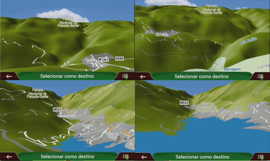
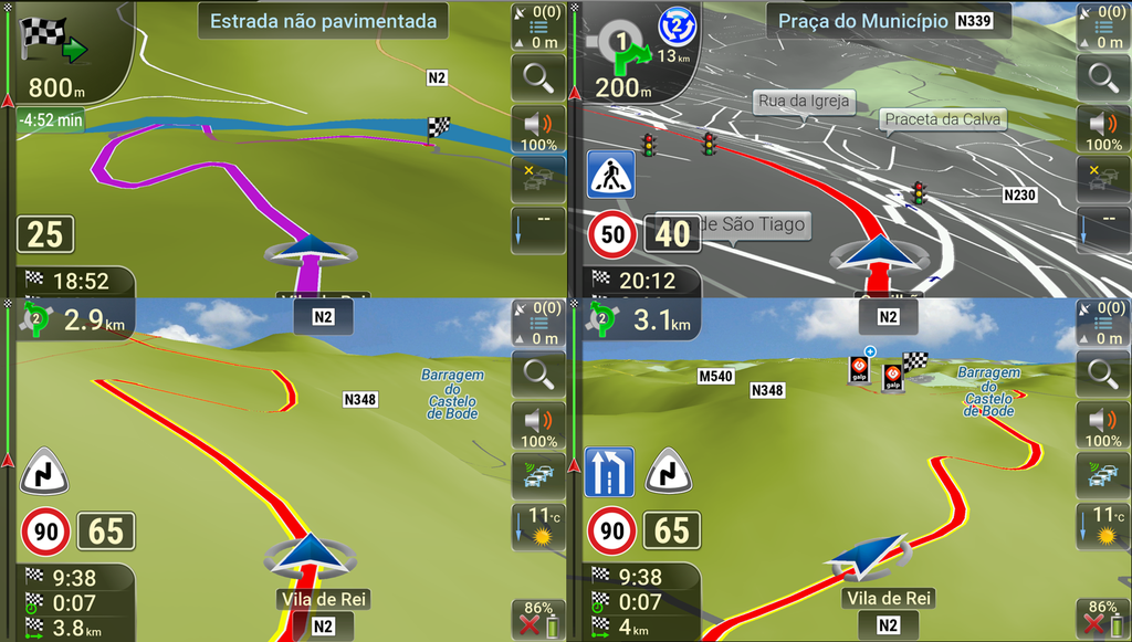
    I've put the DEM files for Europe CGIAR in Igo Primo NextGen and it seems to have accepted it and i can see some elevation shadows from mountains; however when on road, even going thru mountains, everything seems to be quite flat.
    Is there anyway to adjust height map on navigation? Some Sys.txt entry?

    Thank you in advance!

  5. #4
    Member + (DEM) Digital Elevation Model jabicho's Avatar
    Join Date
    Nov 2014
    Location
    Muchos Bandidos Cucaracha Pocha
    Posts
    58
    Rep Power
    15

    Default

    Try this:

    [map]
    3d_buildings=1
    3d_landmarks=1
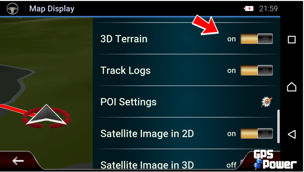
    3d_dem=1; 3D terrain
    3d_dem_detail=2; detail of 3D terrain (0 = none, 1 = low, 2 = medium, 3 = high)
    Last edited by Boki; 3rd January 2019 at 09:34 AM.
    gone fishing...

  6. #5
    Master seria's Avatar
    Join Date
    Oct 2013
    Location
    Portugal
    Posts
    264
    Rep Power
    516

    Default

    Africa.dem
    SRTM data V3, 2006, International Centre for Tropical Agriculture (CIAT) [Only registered and activated users can see links. ]
    If the problem is space and machine resources use this.

    South Africa.dem
    [cgiar]DEM_SouthernAfrica-HiRes_CGIAR_0606
    Hole-filled seamless SRTM data V3, 2006, International Centre for Tropical Agriculture (CIAT)
    Available from [Only registered and activated users can see links. ]
    ~SAF|2006.06||Premium|
    It is recommended if you prefer a more realistic driving.

    Read with [Only registered and activated users can see links. ]

    2s
    [Only registered and activated users can see links. ]

  7. #6
    Member madagascar's Avatar
    Join Date
    Dec 2015
    Location
    EU
    Posts
    19
    Rep Power
    0

    IGO Primo

    This post requires you to click the "LIKE this post" button and hit F5 to read this content.

    Total files size: 4.02GB

    Tnx to @SNB

    n AW2 O
    Attached Files Attached Files

  8. #7
    Important User (DEM) Digital Elevation Model
    (DEM) Digital Elevation Model(DEM) Digital Elevation Model(DEM) Digital Elevation Model(DEM) Digital Elevation Model(DEM) Digital Elevation Model(DEM) Digital Elevation Model(DEM) Digital Elevation Model
    catymag's Avatar
    Join Date
    Nov 2007
    Location
    light side
    Posts
    15,387
    Rep Power
    5121

    Default

    Quote Originally Posted by seamore View Post
    i can not display dem of map tomtom_thailand_2015.Q3
    Nextgen requires premium DEM maps, see the post above yours.
    Try SouthEast_AsiaCGIAR_Premium_2006.06_090311.dem from linked torrent
    l9ebnsm
    You have to navigate to get to the good.

    Galaxy S5 Kitkat 4.4.2 / Nuvi1200->1250 / Nuvi3790T->34xx / Nuvi 2200 / Nuvi 66 / Oregon 600

  9. #8
    Junior Member
    Join Date
    Feb 2016
    Location
    Melbourne
    Posts
    1
    Rep Power
    0

    Default

    I have IGO Primo 2.4 installed and just put in the Australian dem file and set Relief to on, but in the map all I get is very faint contour colours? I noticed when I press the relief buttons it flashes the green colour on the map!
    Can someone tell me how to fix this.

    Thanks
    Clive

  10. #9
    Important User (DEM) Digital Elevation Model
    (DEM) Digital Elevation Model(DEM) Digital Elevation Model(DEM) Digital Elevation Model(DEM) Digital Elevation Model(DEM) Digital Elevation Model(DEM) Digital Elevation Model(DEM) Digital Elevation Model
    catymag's Avatar
    Join Date
    Nov 2007
    Location
    light side
    Posts
    15,387
    Rep Power
    5121

    Default

    Change scheme or edit it
    [Only registered and activated users can see links. ]
    program in post n7 and 8
    l9ebnsm
    You have to navigate to get to the good.

    Galaxy S5 Kitkat 4.4.2 / Nuvi1200->1250 / Nuvi3790T->34xx / Nuvi 2200 / Nuvi 66 / Oregon 600

  11. #10
    Master JOYTURKX's Avatar
    Join Date
    Oct 2014
    Location
    UNDERGROUND
    Posts
    158
    Rep Power
    497

    Default

    ALL 54 IGO DEM FILES + 12 IGO BASEMAP DEM FILES


    Analyzed with Igo View and original named.
    Analyzed with Easy dublicate finder. No dublicate files found.
    Analyzed with Igo Primo. All dem content is active.


    Spoiler: +++
    Argentina_CGIAR_Premium_2006.06_090323 (90.7 MB)
    removed dead link


    Australia_CGIAR_2006.06_080825 (36.2 MB)
    removed dead link


    Australia_CGIAR_Premium_2006.06_090309 (130.9 MB)
    removed dead link


    Australia_NASA_2005.07_070918 (124.9 MB)
    removed dead link


    Benelux_TA_2007.06_071001 (8.0 MB)
    removed dead link


    Brazil_CGIAR_2006.06_080825 (53.7 MB)
    removed dead link


    Brazil_CGIAR_Premium_2006.06_090309 (193.8 MB)
    removed dead link


    Brazil_NASA_2005.07_070918 (187.3 MB)
    removed dead link


    Canada_CGIAR_2006.06_081020 (29.6 MB)
    removed dead link


    Canada_CGIAR_Premium_2006.06_090312 (289.0 MB)
    removed dead link


    Colombia_CGIAR_2006.06_080922 (9.7 MB)
    removed dead link


    Costa_Rica_CGIAR_2006.06_101022 (0.6 MB)
    removed dead link


    DACH_CGIAR_Premium_2006.06_090312 (24.3 MB)
    removed dead link


    DACH_TA_2007.06_071001 (74.1 MB)
    removed dead link


    Eastern_Europe_CGIAR_Premium_2006.06_090309 (100.5 MB)
    removed dead link


    Eastern_Europe_TA_2007.06_070920 (97.2 MB)
    removed dead link


    France_TA_2007.06_071001 (69.1 MB)
    removed dead link


    Great_Britain_Ireland_TA_2007.06_071001 (30.9 MB)
    removed dead link


    Full_Europe_CGIAR_2006.06_081010 (83.5 MB)
    removed dead link


    Full_Europe_CGIAR_Premium_2006.06_090323 (211.9 MB)
    removed dead link


    Full_Europe_CGIAR_Premium_2006.06_120920 (210.7 MB)
    removed dead link


    Full_Europe_NASA_2005.07_071128 (245 MB)
    removed dead link


    Full_Europe_TA_2007.06_071026 (208.9 MB)
    removed dead link


    India_CGIAR_Premium_2006.06_090312 (182.8 MB)
    removed dead link


    Israel_CGIAR_2006.06_080922 (0.6 MB)
    removed dead link


    Israel_NASA_2005.07_071027 (5.9 MB)
    removed dead link


    Italy_CGIAR_Premium_2006.06_090313 (13.7 MB)
    removed dead link


    Italy_TA_2007.06_071001 (42 MB)
    removed dead link


    Mexico_CGIAR_2006.06_080922 (17 MB)
    removed dead link


    Mexico_CGIAR_Premium_2006.06_090310 (59.6 MB)
    removed dead link


    Middle_East_and_Africa_NASA_2005.07_080522 (92.5 MB)
    removed dead link


    Middle_East_CGIAR_Premium_2006.06_090311 (97.5 MB)
    removed dead link


    New_Zealand_CGIAR_Premium_2006.06_090312 (10.6 MB)
    removed dead link


    Russia_CGIAR_Premium_2006.06_090309 (88.3 MB)
    removed dead link


    Russia_East_CGIAR_Premium_2006.06_090310 (218.9 MB)
    removed dead link


    Russia_Eastern_CGIAR_2006.06_081021 (28.5 MB)
    removed dead link


    Russia_Eastern_NASA_2005.07_070928 (28.5 MB)
    removed dead link


    Russia_North_CGIAR_Premium_2006.06_090310 (186.4 MB)
    removed dead link


    Russia_Northern_CGIAR_2006.06_081010 (57.1 MB)
    removed dead link


    Russia_Northern_NASA_2005_07.070928 (56.8 MB)
    removed dead link


    Russia_Western_CGIAR_2006.06_081010 (25.6 MB)
    removed dead link


    Russia_Western_NASA_2005.07_070928 (84.5 MB)
    removed dead link


    Scandinavia_CGIAR_2006.06_081014 (7.8 MB)
    removed dead link


    Southern_Africa_CGIAR_Premium_2006.06_111019 (80.9 MB)
    removed dead link


    SouthEast_Asia_CGIAR_Premium_2006.06_090311 (80.9 MB)
    removed dead link


    SouthEast_Asia_NASA_2005.07_070918 (77.9 MB)
    removed dead link


    Taiwan_Province_of_China_CGIAR_Premium_2006.06_090310 (1.5 MB)
    removed dead link


    United_States_CGIAR_2006.06_081010 (110.3 MB)
    removed dead link


    United_States_NASA_2005.07_070921 (98.1 MB)
    removed dead link


    United_States_NASA_2005.07_070921_detailed (240.1 MB)
    removed dead link


    United_States_NASA_2005.07_080212 (168 MB)
    removed dead link


    USA_CGIAR_Premium_2006.06_090313 (282.6 MB)
    removed dead link


    Western_Europe_CGIAR_Premium_2006.06_090310 (117.8 MB)
    removed dead link


    Western_Europe_TA_2007.06_071008 (117.6 MB)
    removed dead link


    Basemap DEM (44.3 MB)
    removed dead link

    Inside:
    Basemap_Africa_CGIAR_2006.06_081013.dem (2.8 MB)
    Basemap_Africa_NASA_2005.07_080123.dem (2.8 MB)
    Basemap_Eurasia_CGIAR_2006.06_090528.dem (8.7 MB)
    Basemap_Eurasia_CGIAR_2006.06_120920.dem (8.6 MB)
    Basemap_Eurasia_NASA_2005.07_080217.dem (8.7 MB)
    Basemap_North_America_CGIAR_2006.06_081103.dem (4.5 MB)
    Basemap_North_America_NASA_2005.07_070919.dem (4.5 MB)
    Basemap_Oceania_CGIAR_2006.06_081013.dem (1.4 MB)
    Basemap_Oceania_NASA_2005.07_080123.dem (1.4 MB)
    Basemap_South_America_CGIAR_2006.06_081013.dem (2.1 MB)
    Basemap_South_America_NASA_2005.07_080131.dem (2.1 MB)
    Basemap_South_America_CGIAR_2006.06_150701.dem (2.1 MB)


    TOTAL: 5,43 GB (5.833.914.675 bytes)
    Last edited by Andrey Form; 4th May 2022 at 09:44 AM.


Tags for this Thread

Bookmarks

Posting Permissions

  • You may not post new threads
  • You may not post replies
  • You may not post attachments
  • You may not edit your posts
  •