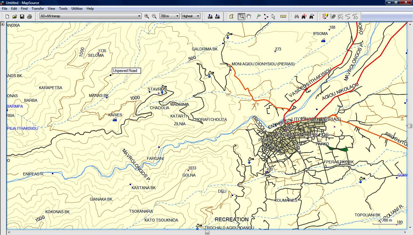
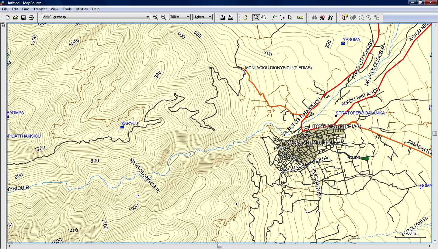
Use two instances of Mapsource. A large screen or two screens makes it even better. You can then select any map and any zoom level indepenently in the instances. For serious route planning this is almost a neccessary method.
Welcome guest, is this your first visit? Click the "Create Account" button now to join.
Results 1 to 10 of 16
Thread: View two mapsets simultaneously
-
23rd May 2013, 04:56 PM #1
 View two mapsets simultaneously
I have a transparent mapset which contains about 600 trails. I would like to view these trails at the same time as a TOPO mapset. i realize that I can combine the mapsets and then send it to the GPS where I can then view them at the same time.
Is there any software that allows simultaneous review of more than on mapset, other than in the GPS?
-
23rd May 2013, 08:10 PM #2

-
24th May 2013, 01:05 AM #3

I am really looking to have the two maps, one on top of the other.
This allows for route planning between trails taking into consideration the best topograhical conditions.
Two monitors each with a different mapset does really help much.
Thanks for your ressponse.
-
24th May 2013, 03:32 AM #4Navigation software expert


- Join Date
- Apr 2009
- Location
- Suomi-Russia
- Age
- 58
- Posts
- 2,149
- Rep Power
- 729

You can add you transparent mapset to topo mapset but it is dependent what topo mapset format you have.
Garmin, how much is 30 pieces of silver for Judas today? Were they worthy for crucifix of GPSPower?
-
24th May 2013, 04:46 AM #5

(see Next Post by X-TRAIL)
If you can also create a track from one of the trails save it as GPX you will be able to see the track together with detailed Map.
Have you tried to connect the GPS that Has the combined Map to computer and use Basecamp. (Change MS switch to 0 using gmaptool)Last edited by dasilvarsa; 24th May 2013 at 10:39 AM.
The difference between stupidity and genius is that genius has its limits.
Albert Einstein.
-
24th May 2013, 09:30 AM #6

I think you can do it.
You can view your transparent mapset (.img file) on top of a solid map (road or topo) using Mapsource or Basecamp.
You'll need to install [Only registered and activated users can see links. ] and [Only registered and activated users can see links. ]
You'll drag 'n drop the two .img files (transparent and solid) on Gmaptool and JOIN them as a new mapset using solid map's MapID for the new mapset.
You'll drag 'n drop the new produced .img file (your new mapset) on Gmaptool again and now you are going to SPLIT it using "files for Mapsource" option and you'll use the MapID that you've used above (solid map's MapID).
Run install.bat in the folder with the splitted image and you're ready!
You must not have previously installed the same solid road or topo map in Mapsource (you must not have installed at the same time, the solid map standalone and in the new mapset because they have the same MapID).
Below there is an example I've made using the solid Greek road map Autodrive and the transparent map of Anavasis (that has only contour lines, rivers, streams and places)
(You can see the river double, as each of the river's blue line is from each map).

Another example is again the solid map Autodrive and a custom transparent map with only contour lines for Greece.


-
24th May 2013, 11:47 AM #7

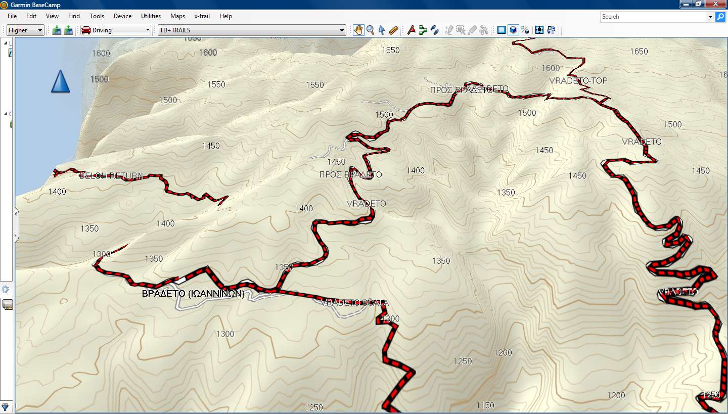
And below I think is exactly what you want.
I've tranformed some of my tracks (.gpx) to a transparent map file (.img) using [Only registered and activated users can see links. ] and created a new mapset using a solid greek Topo Map and my transparent map of tracks.
The red and black color of tracks is due to the custom TYP file I've added to the transparent map.
Mapsource:

Basecamp:


-
24th May 2013, 05:59 PM #8

I managed to do it a different way.
Im Mapsource selected overlapping tiles from streetmap and trails map.
Transfer to 3490 device /memory card/Garmin/Gmapsupp.img
Use Gmaptool to change MS Flag to 0.
Run Basecamp, plug in GPS and both Map and Trails Displayed in BaseCamp.
[Only registered and activated users can see links. ]
I retained Routing Capabilities and Adress Search in both GPS and Basecamp.Last edited by dasilvarsa; 24th May 2013 at 06:01 PM.
The difference between stupidity and genius is that genius has its limits.
Albert Einstein.
-
24th May 2013, 06:14 PM #9

Thank you for all the feedback. I will try the suggestions to see what works best.
-
24th May 2013, 07:08 PM #10

dasilvarsa:
I am trying your last suggestion.
Pardon my lack of experience with Gmaptool.
After loading Gmapsupp.img where do I find the MS flag in Gmaptool and what does it do.
Thanks for your comments and help.


 Likes:

 Reply With Quote


Bookmarks