Would you say that this is usefull for a Mobile XT/Mapsource combination?
I have a bit of a problem with retreiving tracks and planing routs with Mapsource 6.14.1
I solved the tracks issue thanks to this guy, All creeds goes to Theo:
"You first need to use the export function in "Manage my data" to export to the "current.gpx" file and then extract the data with Mapsource."Code:Please Login or Register to see the links
Welcome guest, is this your first visit? Click the "Create Account" button now to join.
Results 1 to 8 of 8
-
21st October 2008, 09:09 PM #1
 GARMIN Trip Waypoint Manager v4+V5.0 update
GARMIN Trip and Waypoint Manager v.4

Requirements: Garmin GPS Device + MapSource
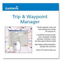
Overview: Simplify pre-trip planning for your next outdoor adventure or business trip by using MapSource Trip & Waypoint Manager to transfer waypoints, routes and tracks between your Garmin GPS and PC.
Image
Simply plan your next trip on a PC, download GPS data to your Garmin unit, and go. Don't forget to use Trip & Waypoint Manager to archive GPS data for future use. Back up waypoints, routes and tracks that you've saved on your Garmin GPS to your PC using the Trip & Waypoint Manager software.
Trip & Waypoint Manager comes with a general worldwide database that provides basic cartography, including interstates, motorways, oceans, and various other general reference detail to help you plan your next trip. Map detail also includes political boundaries, principal cities and towns.
This trip planning CD is designed for use with Garmin units that have no built-in map detail or city point database. See the product compatibility table (above right) for a list of products that Garmin recommends with this software.
Product does not contain any detailed maps. You are not able to download additional map detail to any Garmin GPS unit using this product. This product is not compatible with iQue.
Version v.5 in the latest postLast edited by catymag; 16th October 2014 at 11:52 PM.

You have to navigate to get to the good.
Galaxy S5 Kitkat 4.4.2 / Nuvi1200->1250 / Nuvi3790T->34xx / Nuvi 2200 / Nuvi 66 / Oregon 600
-
15th November 2008, 07:26 PM #2Member


- Join Date
- Sep 2008
- Location
- Sweden
- Posts
- 11
- Rep Power
- 0

-
20th July 2009, 06:20 PM #3

It is an economic tool for transferring data between a Garmin GPS and a computer. It has similar detail to Worldmap (without navigation aids), but does not load maps to the GPS.
Trip and Waypoint Manager software allows you to view a color map of any area in the world.
All features stay in focus no matter what scale, so you can zoom down to a resolution of a few metres. You can easily zoom by rectangular window, or scale, or pan to a particular area in your country, or any other land mass. When you have the desired area shown, with major roads, rivers, towns and highways, you can easily create waypoints with a click, ready for upload to the Garmin GPS. Or you can download waypoints, routes, and tracks from the Garmin, and they will be overlayed on the screen for direct comparison with existing information.

You have to navigate to get to the good.
Galaxy S5 Kitkat 4.4.2 / Nuvi1200->1250 / Nuvi3790T->34xx / Nuvi 2200 / Nuvi 66 / Oregon 600
-
16th October 2014, 08:27 PM #4

Version 5. Extract Part 1 and it and other RAR Parts 2, 3 & 4 will be automatically extracted to folder "Trip & Waypoint Manager V5.0".
Spoiler:
-
5th April 2015, 03:59 PM #5Member


- Join Date
- Aug 2010
- Location
- Oslo
- Posts
- 12
- Rep Power
- 0

So I`m guessimg at this point with Basecamp and Mapsource there is no point in this software, is there?
-
5th April 2015, 04:15 PM #6
-
5th April 2015, 11:48 PM #7
-
23rd November 2015, 01:59 PM #8

Trip & Waypoint Manager V5 new link
This post requires you to click the "LIKE this post" button and hit F5 to read this content.
You have to navigate to get to the good.
Galaxy S5 Kitkat 4.4.2 / Nuvi1200->1250 / Nuvi3790T->34xx / Nuvi 2200 / Nuvi 66 / Oregon 600


 Likes:


Bookmarks