Welcome guest, is this your first visit? Click the "Create Account" button now to join.



 Likes:
Results 1 to 10 of 15
-
26th August 2026, 12:17 AM #1Member


- Join Date
- Mar 2012
- Location
- Italia, Padova
- Age
- 61
- Posts
- 10
- Rep Power
- 0
 .img format to kmz (img2kmz) software
... I'm looking for software by the late Alex to convert maps from .img format to kmz (img2kmz).
Thanks.
-
27th August 2026, 04:56 PM #2Member


- Join Date
- Aug 2026
- Location
- Spain
- Posts
- 13
- Rep Power
- 0
-
27th August 2026, 05:46 PM #3Member
- Join Date
- Mar 2012
- Location
- Italia, Padova
- Age
- 61
- Posts
- 10
- Rep Power
- 0
... thanks but it doesn't convert .img files to KMZ or ... (ecw, rmap, jnx etc.) and max 50mb!
Spoiler: Large Image

Last edited by Boki; 28th August 2026 at 06:27 AM.
-
28th August 2026, 07:19 AM #4Master


- Join Date
- Jan 2014
- Location
- Shut your dog up!!
- Posts
- 89
- Rep Power
- 53
I think OP means garmin's .img map format, not regular images.
Not sure of any online tools though I did play around with GPSMapEdit a while ago that could do this.
Spoiler: Link
From memory the .img files had to first be imported, then saved as .mp (polish) format, then the .mp format files imported then exported to the kmz format.
I think the free version of GPSMapEdit has limitations of maximum .img import size, and remember something about splitting the map/s into smaller .img's with GMapTool or similar.Do big things!

-
28th August 2026, 01:34 PM #5Member
- Join Date
- Mar 2012
- Location
- Italia, Padova
- Age
- 61
- Posts
- 10
- Rep Power
- 0
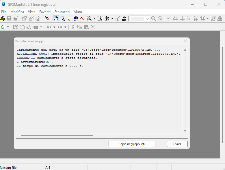
...it doesn't open, see image.
Spoiler: Large Image
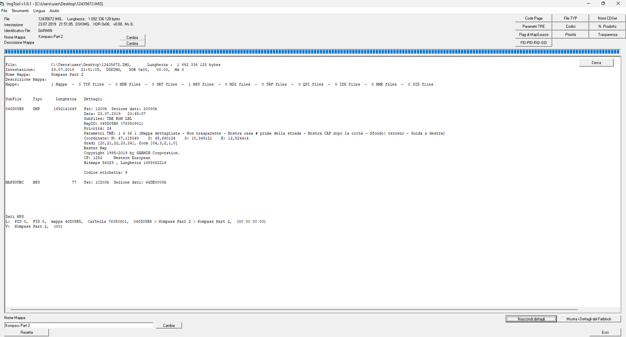
Map details:
Spoiler: Large Image
The map to be converted is a raster map in .img format, with a detail of less than 300 meters. It's read perfectly by Garmin GPS, but we wanted to convert it into a file (such as ... ecw) for smartphone apps (Orux ...).
.gif "hi3")
Last edited by Neil; 28th August 2026 at 10:54 PM. Reason: Remove quote of immediately preceding post. Add Spoiler tags for pics.
-
28th August 2026, 02:25 PM #6Master
- Join Date
- Jan 2014
- Location
- Shut your dog up!!
- Posts
- 89
- Rep Power
- 53
I've never had anything to do with Garmin raster .img's before that I can remember, only vector .img's, and I only know English so don't understand the messages.
The full map file size is about 1.6 GB or thereabouts, is that correct?
If so that'll be too large for the free version of GPSMapEdit to open and it'll have to be split into smaller .img's then each opened individually, that's if it can be done with that particular map.
I don't know if the raster .img is a similar format to the vector .img's I worked with years ago, which were a combination of hundreds of smaller .img's combined into a single map.
I remember splitting a map I was working on into about 300 separate .img's and was then able to import each individually.
It's also possible that GPSMapedit won't open the raster .img's even if they're small enough to be under it's size limit.
From memory it won't open NT maps at all, the free or paid licensed version.
I used to split them with the GmapTool software years ago when I last worked on any myself.Do big things!
-
1st September 2026, 06:56 PM #7Member
- Join Date
- Nov 2014
- Location
- Russia
- Age
- 55
- Posts
- 12
- Rep Power
- 0
Hi!
We are talking about a raster format that was invented by the late Alex. It is used instead of JNX to avoid patching the Garmin firmware.
It’s not very clear why TS needed such a conversion?
Sincerely!
-
2nd September 2026, 01:57 PM #8Member
- Join Date
- Mar 2012
- Location
- Italia, Padova
- Age
- 61
- Posts
- 10
- Rep Power
- 0
...since the Garmin raster map is in .img format with 1:25,000 detail, we wanted to convert it to...rmap, ecw, imp for smartphone apps. Originally Posted by tikhpetr

Alex had created tools for editing and managing gpx, img, etc. files.
Last edited by Neil; 2nd September 2026 at 11:16 PM. Reason: Shorten quote of previous post.
-
9th September 2026, 12:04 PM #9Member
- Join Date
- Nov 2014
- Location
- Russia
- Age
- 55
- Posts
- 12
- Rep Power
- 0
Hi!
If you have a raster map .IMG, probably the source file was JNX? In this case, you can easily convert it to any raster using GM. If you don't have GM, send me a file/link, I'll do everything.Last edited by Boki; 9th September 2026 at 12:42 PM. Reason: removed excessive quote
-
9th September 2026, 02:05 PM #10Member
- Join Date
- Mar 2012
- Location
- Italia, Padova
- Age
- 61
- Posts
- 10
- Rep Power
- 0
Last edited by Boki; 10th September 2026 at 06:12 AM. Reason: removed excessive quote

 Reply With Quote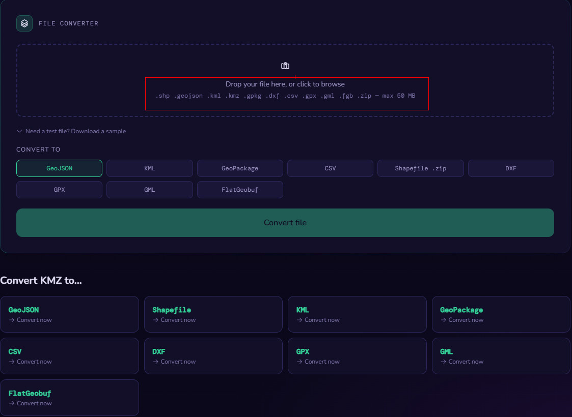


Bookmarks