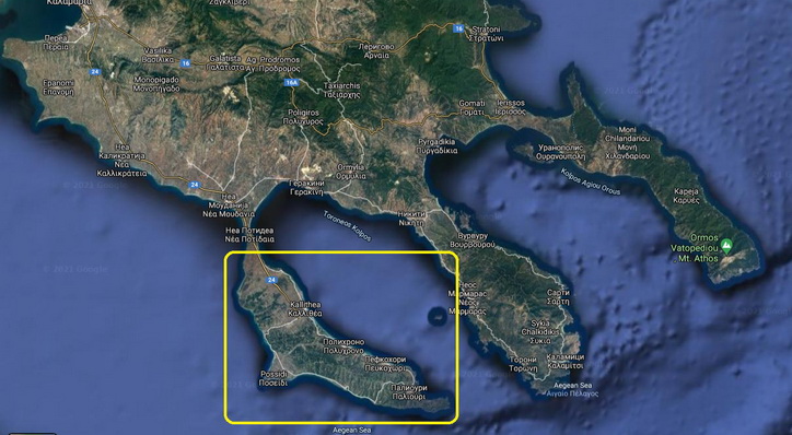
I give you a 18x SHQ raster map of the Kassandra peninsula, Halkidiki, Greece - attached.
Spoiler: picture
Spoiler: GR, Halkidiki, Kassandra
Welcome guest, is this your first visit? Click the "Create Account" button now to join.
Results 51 to 55 of 55
Thread: Raster Maps
-
28th September 2020, 08:38 AM #51GPSPower Friend


- Join Date
- Jan 2015
- Location
- The Netherlands
- Age
- 76
- Posts
- 686
- Rep Power
- 0

@jynie
Found it. You are right, a very small part of London.
Very different from Berlin.
-
4th August 2021, 03:34 PM #52
 Kassandra peninsula, Halkidiki, GR
Last edited by chopsticks; 4th August 2021 at 04:15 PM. Reason: pic added
-
15th August 2021, 06:42 AM #53Member +


- Join Date
- Sep 2015
- Location
- Europe
- Posts
- 67
- Rep Power
- 0

Ok, how do I do this nowadays? SAS crashes with "Unable to load map(s)! Aborting ..."
... wow - I first have to find out that I have to download "Patch SAS Planet Maps (GeoJamal.com).zip"
[Only registered and activated users can see links. ]
and extract it into "maps" folder
- what a program!
AFAIK the black tmp file is always created to fill borders? It doesn't depend on the zoom factor.
I have the offset problem as well. Is there a correct projection I have to select or is there no solution to this problem? The old SAS Planet didn't have the option. What was the default then?
-
18th August 2021, 03:32 PM #54

Last edited by Boki; 18th August 2021 at 08:44 PM. Reason: Unnecessary quote removed
-
23rd April 2022, 11:20 AM #55Member


- Join Date
- Aug 2015
- Location
- Russia
- Posts
- 13
- Rep Power
- 0

Bulgarian raster maps - 848 MB:
Spoiler: Maps
Spoiler: DownloadLast edited by Boki; 23rd April 2022 at 03:50 PM. Reason: unnecessary quote removed


 Likes:
 Reply With Quote


Bookmarks