Well just about any GPS will do that "but since you are total Newbie to this you will need to listen to others and I'm a bit busy at the moment getting ready for my next Gold Hunt in West Ozzy, so if any others comment take note and come back and post your perception of the comments and we will correct and add more info to that. Is hard to say the words but is so easy to be there and show how to do it. "I am more show you that talk about it type thing M8" but this site has so many GPS techy peps would answer your question would be surprised if you didn't get an answer that didn't answer your question.
Neil your up next
Da iggy.
Welcome guest, is this your first visit? Click the "Create Account" button now to join.
Results 1 to 3 of 3
Thread: Suggestions needed. GPS+software
-
18th March 2015, 08:17 PM #1Junior Member


- Join Date
- Mar 2015
- Location
- Michigan
- Age
- 40
- Posts
- 2
- Rep Power
- 0
 Suggestions needed. GPS+software
Hello!
I need some help here. I don't have much experience with the latest GPS systems and software. I'm in hopes of creating a masterpiece!!! This fall I would like to open up a corn maze here in Michigan and would like to construct it using GPS. Is there anyone out there that could suggest a good GPS and compatible software to do so? I need to be able to map the perimeter of the field , import a picture using software into the middle of the field so that I can use my portable GPS to etch out the image into the corn. Any IDeas??
Thanks
-
31st March 2015, 04:47 PM #2Members Administrator


- Join Date
- Nov 2011
- Location
- Western Australia
- Age
- 73
- Posts
- 11,984
- Rep Power
- 2046
 Can't see a link/attachment? Don't post asking why. Just 'Like' the post & hit F5:
THE LIKE BUTTON IS NOW IN THE BOTTOM LEFT-hand CORNER - If you can't see the like button, then you're an Inactive Member
Posts serving no purpose like thanks or to ask about links go to [Only registered and activated users can see links. ] or are deleted, it's GPS Power policy.

-
31st March 2015, 06:47 PM #3

If I understand you correctly, you have a image of a maze or you'll design one and you want to import this image in a GPS program using a US map.
Then you want to export this image as a gps Track (path) to a handheld gps device and you want to etch out this image into the corn by simply following the Track on your handheld device.
It's a piece of cake that you can do in less than 30 minutes with just basic knowledge.
You just need a Garmin "on the trail" device and Garmin's Basecamp
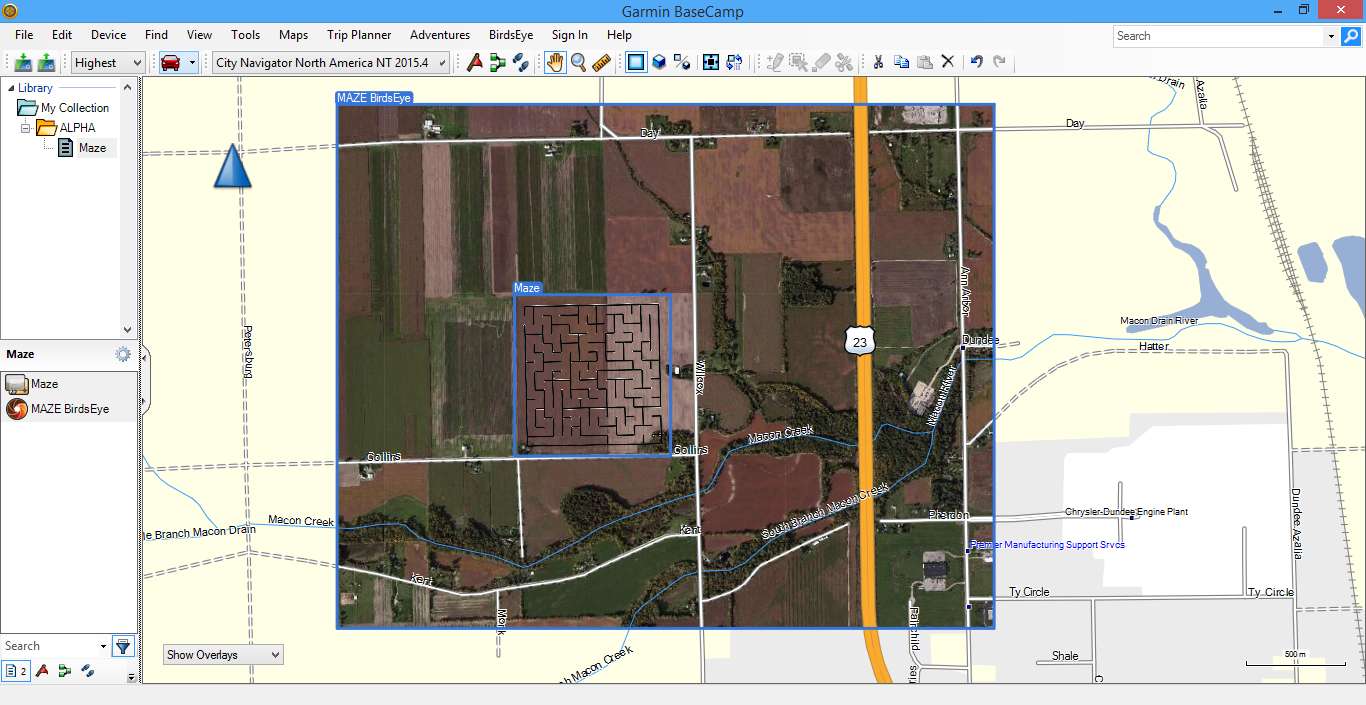
This is what I've created on a farm NE of Dundee,MI

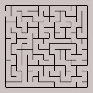
starting with this image


 Likes:
 Reply With Quote
.gif)


Bookmarks