Welcome guest, is this your first visit? Click the "Create Account" button now to join.
Results 1 to 10 of 99
Thread: TOPO France v4.01 PRO
-
24th June 2015, 05:32 AM #1pietuGuest
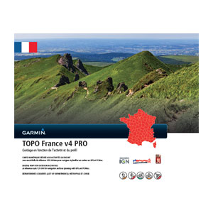
 TOPO France v4.01 PRO
TOPO France v4.01 PRO

Prepare for your next great outdoor adventure in France with this highly detailed topographic mapping product. With fully routable maps and Garmin ActiveRouting¹, it contains versatile route planning for walking and cycling.
- Integrates topographic vector map data from IGN at a scale of 1:25,000 on compatible devices
- Displays content from FFC (mountain bike trails) and GR (hiking trails)
- Plans customized activity routes using ActiveRouting¹, showing routable roads and paths for walking and cycling tours
- Offers thousands of different destination choices with searchable addresses, geographic names and business points of interest
- Provides 3-D view and elevation shading on compatible devices so you can estimate terrain difficulty
Full ActiveRouting capability only with selected devices; depends on Garmin GPS device and software version.
FID: 3080
Image:
Locked:
[Only registered and activated users can see links. ]
UnLocked:
[Only registered and activated users can see links. ]
Code:Please Login or Register to see the links
SQL: (010-D1198-01.db)
Image: SQL FIX (010-D1198-01)
UnLocked:
[Only registered and activated users can see links. ]
Code:Please Login or Register to see the links
Code:Please Login or Register to see the links

Original images
[Only registered and activated users can see links. ]

Code:Please Login or Register to see the links

[Only registered and activated users can see links. ]

Code:Please Login or Register to see the links

[Only registered and activated users can see links. ]

Code:Please Login or Register to see the links

[Only registered and activated users can see links. ]

Code:Please Login or Register to see the links

Last edited by pietu; 14th March 2016 at 12:23 PM.
-
24th June 2015, 12:59 PM #2Important User


- Join Date
- May 2014
- Location
- Where you live
- Posts
- 730
- Rep Power
- 2401

 *****
*****
-
24th June 2015, 04:08 PM #3Junior Member


- Join Date
- May 2015
- Location
- France
- Posts
- 6
- Rep Power
- 0

what does mean SQL and SQLFIX ? Thanks
Garmin 60csx 64s
-
24th June 2015, 04:27 PM #4

SQL file is Active Routing (Named Trails) Database, read about ACTIVE ROUTING DB [Only registered and activated users can see links. ] (bottom of starting post)
To work in gps and in Basecamp and to show trails, .db name must be the same of product number in .img. (006-D1270-02 or 010-D1198-01)
You can change .db name to match the .img prod number or viceversa.
More info here:
[Only registered and activated users can see links. ]
Attached TYP files for Topo France
TYP file for France Topo v4 pro stephpapouTYP file for France Topo V4 pro Gaster(The major changes are
- I have cleared the dark greenish color they resemble more detailed maps.
- I took the vine motif borrowed three-blade, to make them yellow
- I have dark paths and trails to make them more visible.
- bike paths in pale violet turned blue.)
Fichier TYP pour Topo France V4 pro de japy
(The purpose of this Type is to make it more readable as possible the map ( without backlight) on an Oregon 600
Credits: sorcieremonique forum members
You have to navigate to get to the good.
Galaxy S5 Kitkat 4.4.2 / Nuvi1200->1250 / Nuvi3790T->34xx / Nuvi 2200 / Nuvi 66 / Oregon 600
-
24th June 2015, 04:28 PM #5

SQL contains the database for ActiveRouting. For the database to work, its filename must match the header of the map file. This is not the case with the original map file, hence the fixed version.
Edit: beaten by Caty.
Edit 2: This map has CP 1252. This means it will work fine on units like GPSmap 64 and Edge 1000 when unlocked with [Only registered and activated users can see links. ]Last edited by smokefree; 24th June 2015 at 05:00 PM.
-
24th June 2015, 06:03 PM #6Junior Member


- Join Date
- Jun 2015
- Location
- Netherlands
- Posts
- 4
- Rep Power
- 0

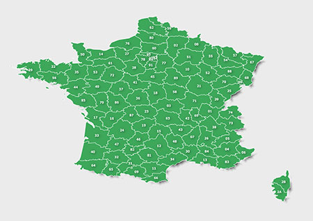
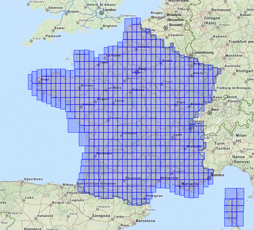
Thanks but hey big map sections missing around Briancon etc east side of france
Downloaded from zippy.
Each section 2004.800kb except last 51,
.202
So.....what to do please?
-
24th June 2015, 06:20 PM #7Junior Member


- Join Date
- May 2015
- Location
- France
- Posts
- 6
- Rep Power
- 0

TopoFranceV4 pro UL works fine on 64s
Garmin 60csx 64s
-
24th June 2015, 06:39 PM #8
-
24th June 2015, 07:44 PM #9

Locked map from Zippy is ok for me too, unrared fine and works perfectly. Thanks pietu and Navigator

sent with my phone
You have to navigate to get to the good.
Galaxy S5 Kitkat 4.4.2 / Nuvi1200->1250 / Nuvi3790T->34xx / Nuvi 2200 / Nuvi 66 / Oregon 600
-
24th June 2015, 08:21 PM #10

works fine for me !! Garmin Oregon 650
TopoFranceV4 pro UL
Thanks


 Likes:
 Reply With Quote


Bookmarks