Welcome guest, is this your first visit? Click the "Create Account" button now to join.
Results 1 to 10 of 41
Thread: TOPO Australia & New Zealand v5
-
22nd November 2014, 06:45 PM #1
 TOPO Australia & New Zealand v5
TOPO Australia & New Zealand v5 Locked
[Only registered and activated users can see links. ]
Part Number: 010-D0209-00
More info:Code:Please Login or Register to see the links
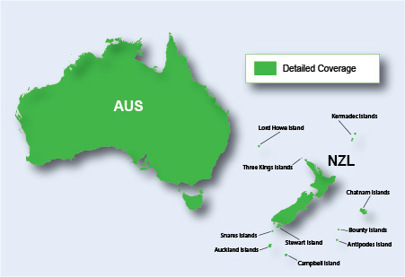
Get enhanced topographic detail on your compatible device whether you're in the outback or on a main boulevard in the city. This map provides a wide array of topographic information from terrain contours, elevations and summits to coverage of perennial and intermittent lakes, rivers and streams in Australia and New Zealand.
- Provides terrain contours and summit points at 10 m intervals for a more detailed view of the terrain
- Contains more than 105,000 km of tracks, roads and outback trails; also displays 4WD destinations and hydrographic features: lake/river shorelines and perennial and seasonal streams
- Includes built-in DEM data with 3-D shading and route elevation profiles on compatible devices so you can estimate terrain difficulty
- Offers updated and new searchable points of interest in urban, rural and outback areas, including lodging, restaurants, homesteads, parks, shopping and more than 4,000 camping locations
- Displays updated routable road content, by HERE, to give you turn-by-turn directions to your destination
- (DVD only) Includes BaseCampô software, allowing you to view, manage and transfer waypoints, routes and tracks on your computer and GPS
Code:Please Login or Register to see the links
Download is hidden
This post requires you to click the "LIKE this post" button and hit F5 to read this content.
Unlock with: [Only registered and activated users can see links. ]
-
23rd November 2014, 12:29 AM #2pietuGuest

Last edited by pietu; 31st January 2016 at 11:00 AM.
-
23rd November 2014, 11:19 AM #3

@Kenta: original part number: 010-D0209-00 (=download version)
gmapsupp.img gives : 006-D1325-03 . It is not an existing Garmin number.
That kind of number gives Mapinstall when You make a smaller map from a PC (gmap)-version.
Can you explain it?
-
23rd November 2014, 11:39 AM #4

@bommelb
This is a Downloaded original IMG file so I do not know why part number is different
-
24th November 2014, 05:56 PM #5

Download Instructions:
Spoiler: download
inside
unlocked image file
hoster
filefactory.com
share-online.biz
-
25th November 2014, 05:29 AM #6Master


- Join Date
- Jun 2006
- Location
- GPS Underground
- Age
- 19
- Posts
- 399
- Rep Power
- 421

The Topo maps are awfully brown in a base colour and makes them difficult to see on the Etrex!
Is there any way to remove or change the colur of the base brown map color???
The other topo shadings should remain ok but just to get rid of the base brown color...

--------------------------------
gimgtools-0.03-win32.zip
Code:Please Login or Register to see the links

Last edited by Schermann; 25th November 2014 at 06:52 AM.

-
25th November 2014, 11:33 AM #7

You can make a new typ, see how to in Creating Maps section.
sent with my phone
You have to navigate to get to the good.
Galaxy S5 Kitkat 4.4.2 / Nuvi1200->1250 / Nuvi3790T->34xx / Nuvi 2200 / Nuvi 66 / Oregon 600
-
25th November 2014, 01:40 PM #8Master


- Join Date
- Jun 2006
- Location
- GPS Underground
- Age
- 19
- Posts
- 399
- Rep Power
- 421

I have been trying out this app that seems to have a similar color set to Garmin maps...
[Only registered and activated users can see links. ]
[Only registered and activated users can see links. ]
Code:Please Login or Register to see the links


-
25th November 2014, 01:46 PM #9

Look at threads I pointed in Creating Maps section, you can learn how to do and even ask typviewer author for some tips.
sent with my phone
You have to navigate to get to the good.
Galaxy S5 Kitkat 4.4.2 / Nuvi1200->1250 / Nuvi3790T->34xx / Nuvi 2200 / Nuvi 66 / Oregon 600
-
25th November 2014, 08:53 PM #10

@ Schermann
Like TOPO Australia & New Zealand v5, most Topo Maps have transparent background, that's why you see it as white color in Basecamp.
It is transparent only where you don't have polygons like parks, cities, land coverage etc.
What you see on your device as background is the colored Basemap, which changes from green for valleys to brown for mountains.
Add a solid background color of your choice to the original TYP (polygon 0x10d 01 (NT) with DrawOrder 01) and your Basemap is going to disappear!
Another "brown" problem with Topo Maps is that Garmin gives a "default" brown color to the Height Contour Lines and they are ...too many!
So you have to add to the original TYP the 3 Contour Lines categories (for NT) but you have to be very careful with the color of your choice, so that it is not a color that other lines have in the map.
To get a good result, especially when you are zoomed out, it's trial and error method...
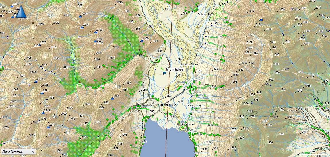
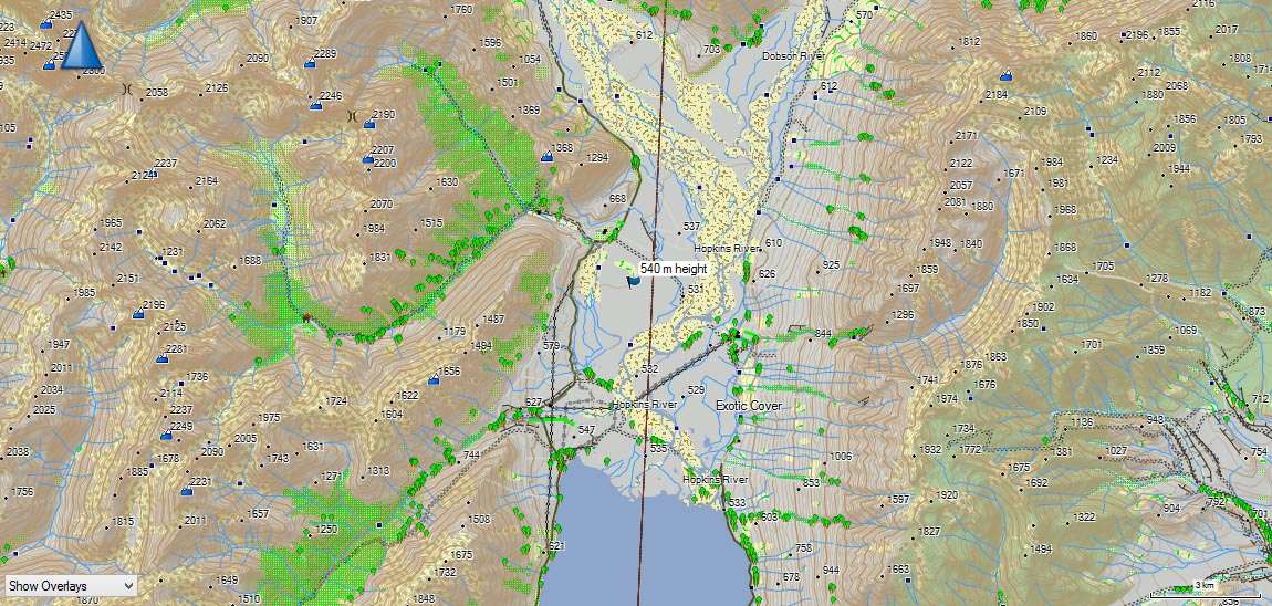
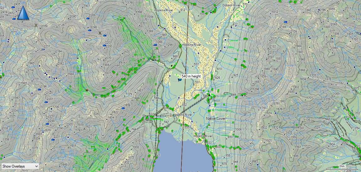
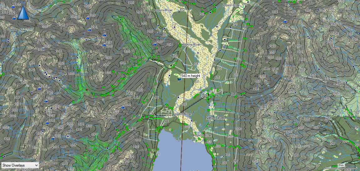
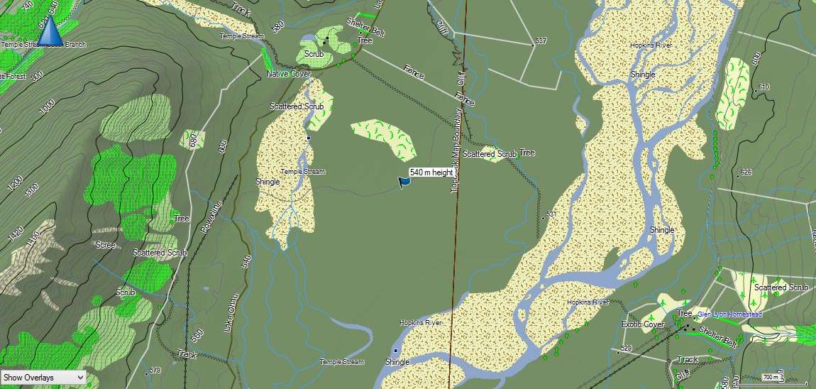
Below there are Basecamp screenshots from TOPO Australia & New Zealand v5.
The first one is with the original TYP (white -transparent for devices- background)
(The green areas that you see are polygons defined by the maker of the map).
The second has grey solid background and the default brown color for the Contour Lines.
The third has light green solid background and grey Contour Lines.
The forth has green solid background and dark grey to black Contour Lines.
You can see how the crowded Contour Lines alter the color of the map at big zooms but not when you zoom in!!!
At the end, it's a matter of personal taste!
If you add a solid background you don't loose the photo-realistic 3D shading on the device (and Basecamp).
Spoiler: Screenshots


 Likes:

 Reply With Quote


 or [Only registered and activated users can see links.




Bookmarks