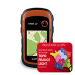
Strange, all the 9 maps have FID 2898. Only the VendorID is different (1-9)
I think I get a problem on my gps with 2 or more of these Light maps with the same FID ?.
Will try it these evening.
Welcome guest, is this your first visit? Click the "Create Account" button now to join.
Results 1 to 10 of 14
Thread: TOPO France v3 LIGHT
-
30th June 2013, 10:16 PM #1Ex Staff Member


- Join Date
- Nov 2010
- Location
- somewhere
- Posts
- 260
- Rep Power
- 0
 TOPO France v3 LIGHT
TOPO France v3 LIGHT

Let us guide you on all of your recreational and outdoor adventures. This product offers digital vector maps, comparable to 1:50,000 scale, for 9 French regions (each sold separately), so you'll have comprehensive coverage for all your outdoor activities.
- Provides routability on the entire road and trail network, including unpaved roads and trails.
- Displays FFRP hiking trails and FFC bike trails.
- Shows land coverage, including forests, shrubs, glaciers, orchards, lakes, wetlands and urban areas.
- Includes contour lines, DEM, searchable geographic places and mountain ranges.
TOPO France v3 LIGHT - Region A
Spoiler: click
Code:Please Login or Register to see the links
TOPO France v3 LIGHT - Region B
Spoiler: click
Code:Please Login or Register to see the links
TOPO France v3 LIGHT - Region C
Spoiler: click
Code:Please Login or Register to see the links
TOPO France v3 LIGHT - Region D
Spoiler: click
Code:Please Login or Register to see the links
TOPO France v3 LIGHT - Region E
Spoiler: click
Code:Please Login or Register to see the links
TOPO France v3 LIGHT - Region F
Spoiler: click
Code:Please Login or Register to see the links
TOPO France v3 LIGHT - Region G
Spoiler: click
Code:Please Login or Register to see the links
TOPO France v3 LIGHT - Region H
Spoiler: click
Code:Please Login or Register to see the links
TOPO France v3 LIGHT - Region I
Spoiler: click
Code:Please Login or Register to see the links
Last edited by P33dro; 2nd September 2013 at 09:38 PM.
-
1st July 2013, 05:13 PM #2

-
1st July 2013, 05:20 PM #3

gps will see it as a single map, you wont be able to deselect parts I guess.

You have to navigate to get to the good.
Galaxy S5 Kitkat 4.4.2 / Nuvi1200->1250 / Nuvi3790T->34xx / Nuvi 2200 / Nuvi 66 / Oregon 600
-
1st July 2013, 06:53 PM #4

I put the C and D Region maps on my Oregon 600 and put a waypoint on the border of the 2 maps (for fast viewing the maps on the gps).
I can enable/disable both maps separatly. Enable one of the two maps works fine, but also enable both maps works fine. Around the waypoint it looks then as 1 combined map even map Region D includes a part of map Region C.
Also a route from map D to map C, with both maps enabled, works fine on the gps.
I think Garmin has made a good decision to use the same FID for the maps, with a different vendorID.
(So there is no need to join these maps with GMaptool.)
-
2nd July 2013, 08:33 AM #5VIP Master


- Join Date
- Jun 2011
- Age
- 55
- Posts
- 9
- Rep Power
- 0

Hello:
I would like to see all the maps with Basecamp, but when I have tried to mix all the maps whit Gmaptool a message appears saying:
File missing: TOPO FRANCE v3 LIGHT - Region C .img. Aborting install.
Any idea?
Thanks[Only registered and activated users can see links. ]
This is the Gmaptool image[Only registered and activated users can see links. ]
Sorry, the file missing is:
File missing: TOPO FRANCE v3 LIGHT-.img. Aborting install.Last edited by catymag; 2nd July 2013 at 10:45 AM. Reason: merged consecutive posts
-
2nd July 2013, 10:32 AM #6

@ calcatoupas
Sorry...but why join the map? Use the [Only registered and activated users can see links. ]
You don't use the file SQL (from V3 PRO) and ....enjoyTOPO France V3 Light

La carte TOPO France V3 light est une carte pourvue d'une fonction de guidage sur les routes et les sentiers sur le GPS ou via le logiciel BaseCamp. Cette carte est parfaitement adaptée pour les produits qui ne peuvent pas bénéficier de la fonction
« ActiveRouting »
France V3 PRO: Découvrez la carte topographique numérique de Garmin qui intègre les données d'IGN à l'échelle 1/25 000éme.
France V3 LIGHT: Données IGN au 1/25 000ème
Bye,bye
-
2nd July 2013, 10:54 AM #7


You have to navigate to get to the good.
Galaxy S5 Kitkat 4.4.2 / Nuvi1200->1250 / Nuvi3790T->34xx / Nuvi 2200 / Nuvi 66 / Oregon 600
-
2nd July 2013, 11:20 AM #8

Hi,
Let's see what's Garmin says about Topo France v3 light on french Garmin site.
Here are answers to two questions :
1- During the download of a zone, may I define a different location other than internal memory of my GPS, as for example a microSD card ?
No, download platform only authorizes location in internal memory recording of light zones .
2- Is it possible to merge two light zones to allow continuous navigation between these two zones?
No, it will be necessary you to tip over from a display to the other one to pursue the navigation.
.gif)
-
2nd July 2013, 10:28 PM #9VIP Master


- Join Date
- Jun 2011
- Age
- 55
- Posts
- 9
- Rep Power
- 0

Ok Catymag. I downloaded the Gmaptool lastest version and everything works fine, but is LIGTH the same as topo France v3 ?
Many thanks
-
2nd July 2013, 10:54 PM #10

Hi,
No, Topo France pro v3 (3,5 Gb) is far more detailed than Topo France light (1,5 Gb).


 Likes:
 Reply With Quote


Bookmarks