After some trial and error I was successful!
A big Thank You!!!
Welcome guest, is this your first visit? Click the "Create Account" button now to join.
Results 1 to 10 of 25
-
9th January 2013, 03:43 PM #1
 TrakMaps Snowmobile Canada New Brunswick up to v4.0.1
Trakmap Snowmobile New Brunswick v1.0.1
[Only registered and activated users can see links. ]
Official trails of the New Brunswick Federation of Snowmobile Clubs (NBFSC)
�7,300 km of trails
�Power lines, railroad tracks, etc.
�900 POIs all along your way
�Routable mode with integrated map background at 1:50,000
�Latest data from the New Brunswick Federation of Snowmobile Clubs (NBFSC), CanVec
Code:Please Login or Register to see the links
Locked .imgCode:Please Login or Register to see the links
FID 1877
Unlock with gimgunlock. To display it in Basecamp change MS flag to 0 with GmapTool.
[Only registered and activated users can see links. ]
Download
This post requires you to click the "LIKE this post" button and hit F5 to read this content.
Last edited by catymag; 16th August 2013 at 03:42 PM. Reason: new link

You have to navigate to get to the good.
Galaxy S5 Kitkat 4.4.2 / Nuvi1200->1250 / Nuvi3790T->34xx / Nuvi 2200 / Nuvi 66 / Oregon 600
-
17th August 2013, 08:40 PM #2Junior Member


- Join Date
- Aug 2013
- Location
- NS
- Posts
- 2
- Rep Power
- 0

-
19th August 2013, 04:20 PM #3Junior Member


- Join Date
- Aug 2013
- Location
- NS
- Posts
- 2
- Rep Power
- 0

The maps will work for a few hours and then mapsource stops working period and or I get a message saying there is a problem with mapsource and do you want to send Garmin a message regarding the problem.
Thanks
-
19th August 2013, 04:32 PM #4

Use Mapsetoolkit to see which error you get in your registry.
Spoiler: mapsettoolkit-v-1-50-beta-v-1-62-beta-v-1-75-beta-v-1-77-a
Do you get error in Basecamp too?Last edited by Pungente; 24th January 2014 at 02:30 AM.

You have to navigate to get to the good.
Galaxy S5 Kitkat 4.4.2 / Nuvi1200->1250 / Nuvi3790T->34xx / Nuvi 2200 / Nuvi 66 / Oregon 600
-
24th January 2014, 01:00 AM #5Junior Member


- Join Date
- Jan 2013
- Location
- Canada
- Posts
- 8
- Rep Power
- 0

Andymann, i still have that working fine,you know where to reach me if you need a hand.Used it all last winter,thanks to catymag,love,love,love it.Don,t leave home on the snowmobile without it....
-
14th May 2015, 12:04 PM #6Junior Member


- Join Date
- May 2015
- Location
- wonedrfull place
- Posts
- 1
- Rep Power
- 0

gutterboy2ca can you please upload it again, all links in first post are dead now. thank you.
-
14th May 2015, 12:53 PM #7

new link in starting post

You have to navigate to get to the good.
Galaxy S5 Kitkat 4.4.2 / Nuvi1200->1250 / Nuvi3790T->34xx / Nuvi 2200 / Nuvi 66 / Oregon 600
-
6th January 2016, 02:08 AM #8

TrakMaps Snowmobile Canada New Brunswick v4.0.1
[Only registered and activated users can see links. ]
FID 5532 (non routable version)Code:Please Login or Register to see the links
FID 5531 (routable version)
non locked
download (non routable):
This post requires you to click the "LIKE this post" button and hit F5 to read this content.
Routable:
This post requires you to click the "LIKE this post" button and hit F5 to read this content.
You have to navigate to get to the good.
Galaxy S5 Kitkat 4.4.2 / Nuvi1200->1250 / Nuvi3790T->34xx / Nuvi 2200 / Nuvi 66 / Oregon 600
-
6th January 2016, 02:33 PM #9


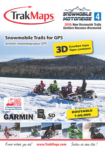
Complete coverage of 2015-2016 official NBFSC trails
Completely reviewed and improved, serious snowmobile enthusiasts use Snowmobile New Brunswick to find their way around safely.
- Routable map to create trail itineraries
- 3D display and contour lines
- Map background at 1:50,000
- 7,500+ km of trails on your GPS unit
- Local trails, provincial trails
- Road network
- Cellular towers
- National and provincial parks
- Wildlife Management Zones (WMZ)
- Buildings, pylons, power lines, bridges, dams, railroads other points of reference
- Lakes, rivers, streams, wetlands, waterfalls
- 2,000+ POIs including lodging, restaurants, gas stations, ATMs
- Superimposable transparent map of the trails
(not available with preprogrammed cards)
Sources : New Brunswick Federation of Snowmobile Clubs (NBFSC), Natural Resources Canada, GeoNB, Natural Resources New Brunswick, TrakMaps
Scale: 1:50,000
Release Date: 2015-09-22
Size of Product: 72 MB+
Please note that trail products for Lowrance have been discontinued and we apologize for any inconvenience this may cause.Last edited by quebec001; 6th January 2016 at 02:44 PM.
-
6th January 2016, 03:06 PM #10

My version is v4.0.1: newer (Typ is of Oct 15) I think it has been released on November.

You have to navigate to get to the good.
Galaxy S5 Kitkat 4.4.2 / Nuvi1200->1250 / Nuvi3790T->34xx / Nuvi 2200 / Nuvi 66 / Oregon 600


 Likes:


 Reply With Quote


Bookmarks