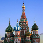
cityXplorer Asia - Moscow & St. Petersburg v.2013.10 Russia FID 800
Moscow
About Coverage
Includes detailed road maps and points of interest for the City of Moscow, Russia, with the ability to navigate using buses, tramway, metro and suburban rail systems (where available. Not all cities include all public transit types).
Features detailed coverage for the greater Moscow metro area, including Sheremetyevo (SVO), Domodedovo (DME) and Vnukovo (VKO) international airports; the okrugs of Northern, North-Eastern, Central, Southern, South-Eastern, South-Western and Western; and the cities of:
◦Firsanovka
◦Odintsovskiy Rayon
◦Leninskiy Rayon
◦Pressa
◦Mechta
Partial geographic coverage is included for the okrugs of North-Western and Eastern.
*Coverage area map shows major roads, highways and points of interest only. Enhanced pedestrian navigation coverage varies within the area shown.
More infos
Version: 2013.10Code:Please Login or Register to see the links
Released: May, 2012
Part Number: 010-D0707-00
To unlock Public Transports add an .unl file made with FID 800. It will work in every compatible device
see:
[Only registered and activated users can see links. ]
download
[Only registered and activated users can see links. ]
click -->
3D map locked
[Only registered and activated users can see links. ]
----------------------------------------------------------------------------------------------------------------------
St. Petersburg
About Coverage
Includes detailed road maps and points of interest for the City of St. Petersburg, Russia, with the ability to navigate using buses, tramway, metro and suburban rail systems (where available. Not all cities include all public transit types).
Features detailed coverage for the greater St. Petersburg metro area, including Pulkovo International (LED) airport, and 17 of the 18 city districts:
◦Admiralteysky
◦Frunzensky
◦Kalininsky
◦Kirovsky
◦Kolpinsky
◦Krasnogvardeysky
◦Krasnoselsky
◦Kronshtadtsky
◦Kurortny
◦Nevsky
◦Petrodvortsovy
◦Petrogradsky
◦Primorsky
◦Pushkinsky
◦Tsentralny
◦Vasileostrovsky
◦Vyborgsky
Partial geographic coverage is provided for the district of Moskovsky.
*Coverage area map shows major roads, highways and points of interest only. Enhanced pedestrian navigation coverage varies within the area shown
more infos
Version: 2013.10Code:Please Login or Register to see the links
Released: May, 2012
Part Number: 010-D0706-00
To unlock Public Transports add an .unl file made with FID 800. It will work in every compatible device
see:
[Only registered and activated users can see links. ]
download
[Only registered and activated users can see links. ]
click -->
3D map locked
[Only registered and activated users can see links. ]
Original files in post n9
New links in post #26
Credits pop222
Welcome guest, is this your first visit? Click the "Create Account" button now to join.
Results 21 to 26 of 26
Threaded View
-
7th May 2012, 11:17 PM #1
 cityXplorer Asia - Moscow & St. Petersburg 2013.10 Russia FID 800

You have to navigate to get to the good.
Galaxy S5 Kitkat 4.4.2 / Nuvi1200->1250 / Nuvi3790T->34xx / Nuvi 2200 / Nuvi 66 / Oregon 600


 Likes:


 Reply With Quote

Bookmarks