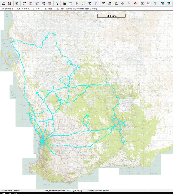
He he but we weren't around then Andrey, but on saying that I have been doing Digital mapping since 1998, downloading maps in what ever format I could and digitally co-ordinating them into software for moving maps "mainly Topo maps and in the mining industry of mining Tenements for gold prospecting" it was important that you knew where you were on a leaseholders plot or suffer a $10,000AUD fine and most of the time it only took an email to the owner to get permission to be on the lease.
Today I still use the same app from 1998 and another one since 2020 and have been in liaison with the developer to add maps to the app for Western Australians, and he has added similar maps for the other states in Australia.
The only feature I use from here is TomTom NDS just for fun, I know how far my next fuel stop is, and when I go off-road it gets lost. I then switch to my mapping apps.
Fun days I have, I have been doing Prospecting long before digital mapping.
Spoiler: Big pic of trails
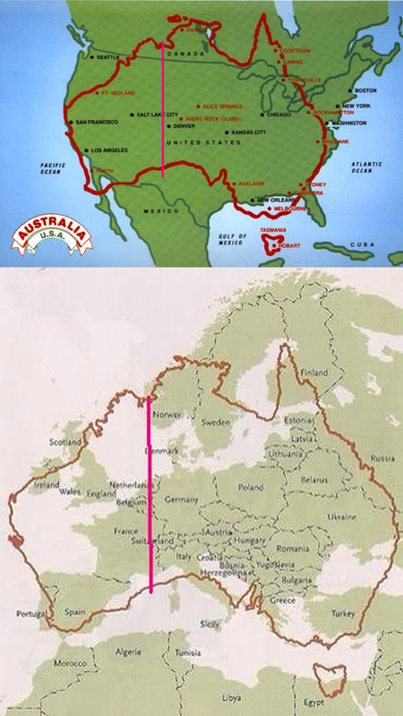
Spoiler: Big pic of Australia over EU & USA
I have been outside the left of the red line
Long before mapping and travelled to Melbourne some 3500km and up the middle to Alice Springs then across into NSW and up to QLD probably past Neil's place, then back down the central area collecting rocks and minerals then to Melbourne to catch up with the in-laws and back via SA to WA home, probably a little joint of some 10,000km or so, just a short trip.
We Australians consider a few 100Km a short trip.
Just sayin.
Welcome guest, is this your first visit? Click the "Create Account" button now to join.
Results 1 to 4 of 4
Hybrid View
-
29th September 2025, 12:35 PM #1Members Administrator


- Join Date
- Nov 2011
- Location
- Western Australia
- Age
- 73
- Posts
- 11,889
- Rep Power
- 1997
 Can't see a link/attachment? Don't post asking why. Just 'Like' the post & hit F5:
THE LIKE BUTTON IS NOW IN THE BOTTOM LEFT-hand CORNER - If you can't see the like button, then you're an Inactive Member
Posts serving no purpose like thanks or to ask about links go to [Only registered and activated users can see links. ] or are deleted, it's GPS Power policy.


 Likes:

.gif)


 Reply With Quote

Bookmarks