I am unsure how to use this with Home Port. I am not a newbie with a Nuvi but this is something totally different. Thanks in advance for any and all help.
Welcome guest, is this your first visit? Click the "Create Account" button now to join.
Results 1 to 5 of 5
-
21st August 2010, 08:54 PM #1
 Inland Lakes Vision: VUS202R - Inland Lakes North Central (4.00)
Inland Lakes Vision: VUS202R - Inland Lakes North Central (4.00)
Inland Lakes Vision: VUS202R - Inland Lakes North Central (4.00)


more infos
Code:Please Login or Register to see the links
Overview
See the Lake in 3-D
You've never seen a lake like this! Inland Lakes Vision is our premium version of Inland Lakes, which provides even more detail for select inland lakes, rivers and waterways throughout the region.
See high-definition shoreline, bathymetric detail, depth contours, boat ramps, mile markers and more on your compatible chartplotter. Inland Lakes Vision offers comprehensive coverage of freshwater lakes plus you'll get special vision technology for many of the most popular lakes. Maps also include wrecks and obstructions, streams and channels, major roads and highways, and more.
The Vision product provides even richer detail with high-resolution satellite imagery and 3-D surroundings, both above and below the waterline, for MarinerEye and FishEye perspectives for select lakes. Plus, get Auto Guidance technology which simplifies navigation by suggesting the best routes.
Available as a download only. Check the Products tab to see whether this map is compatible with your Garmin device¹.
Inland Lakes Vision map features such as high-definition shoreline, bathymetric detail, depth contours, boat ramps, and mile markers can be viewed on most Garmin GPS units. However, to view Vision technology features (satellite imagery, Auto Guidance, FishEye or MarinerEye views), customers must use one of the following Vision compatible GPS units: GPSMAP® 420/420s, 421/421s, 430/430s, 431/431s, 440/440s, 440sx, 440x, 441/441s, 520/520s, 521/521s, 525/525s, 526/526s, 530/530s, 531/531s, 535/535s, 536/536s, 540/ 540s, 541/541s, 545/545s, 546/546s, 620, 640, 720/720s, 740/740s, 4008, 4010, 4012, 4208, 4210, 4212, 5008, 5012, 5015, 5208, 5212, 5215, 6008, 6012, 6208, 6212, 7012, 7015, 7212, 7215.
¹Not all features of this map will work with nüvi® devices.
Features
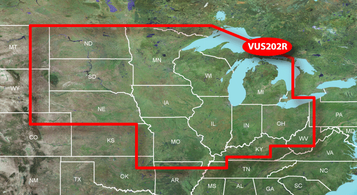
Contains coverage of freshwater lakes in North Dakota, South Dakota, Illinois, Indiana, Iowa, Michigan, Minnesota, Missouri, Nebraska, Ohio and Wisconsin.
Includes full coverage of lakes that extend into neighboring states. Bull Shoals, Norfolk and Table Rock lakes in Missouri/Arkansas and Pymatuning Reservoir and Shenango River Lake in Pennsylvania/Ohio are covered in their entirety.
Provides even richer detail for many popular lakes.
Includes lakes with high-definition shoreline and bathymetric detail.
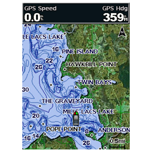
Includes high resolution satellite imagery for selected lakes, providing you with unparalleled situational awareness.
Provides MarinerEye view for selected lakes, showing your surroundings in 3-D so you can gauge your position quickly and reliably.
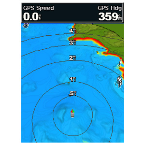
Provides FishEye view for selected lakes, showing your surroundings below the waterline in 3-D, including bathymetric detail.
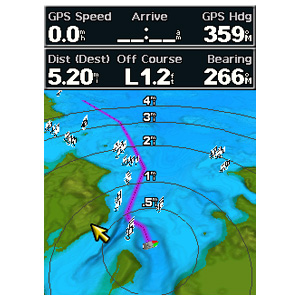
Includes Auto Guidance for selected lakes, which searches map data to suggest the best passage to a destination.
Includes rivers, streams and river and creek channels.
Allows you to search by lake or by city.
Includes interstates, highways and general roads.
No MapID found with GMapTool and it seems to be unlocked by default
inland lakes north central v400.rar -1 RAR archive, unpacked size 546.045.952 bytes
This post requires you to click the "LIKE this post" button and hit F5 to read this content.
credits to rv8a_builder and pokerfaceLast edited by catymag; 23rd May 2015 at 12:32 PM. Reason: link renewed

You have to navigate to get to the good.
Galaxy S5 Kitkat 4.4.2 / Nuvi1200->1250 / Nuvi3790T->34xx / Nuvi 2200 / Nuvi 66 / Oregon 600
-
8th November 2010, 11:58 AM #2f250troubleGuest

-
8th November 2010, 03:08 PM #3

to see it ,put the img in a Garmin folder ,in an sd or pendrive and run Homeport

You have to navigate to get to the good.
Galaxy S5 Kitkat 4.4.2 / Nuvi1200->1250 / Nuvi3790T->34xx / Nuvi 2200 / Nuvi 66 / Oregon 600
-
15th March 2013, 10:40 PM #4Junior Member


- Join Date
- Apr 2012
- Location
- Cowville
- Posts
- 4
- Rep Power
- 0

the liks expired again indeed can you please reupload thanks
-
16th March 2013, 02:04 AM #5


You have to navigate to get to the good.
Galaxy S5 Kitkat 4.4.2 / Nuvi1200->1250 / Nuvi3790T->34xx / Nuvi 2200 / Nuvi 66 / Oregon 600


 Likes:


 Reply With Quote

Bookmarks