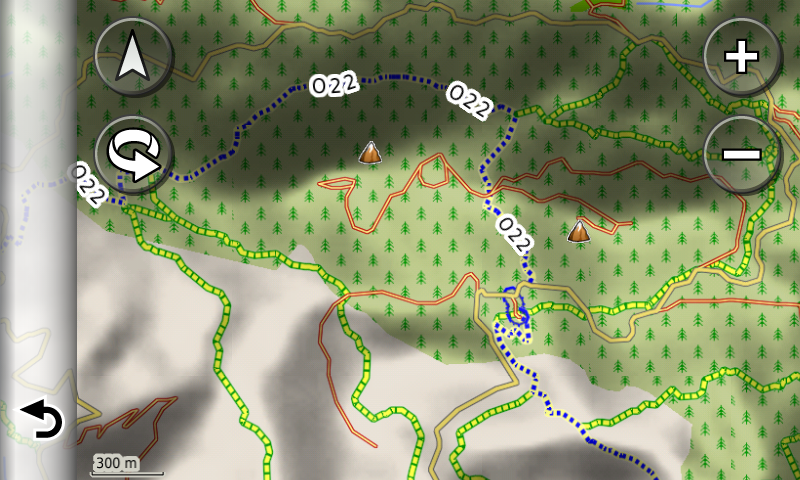
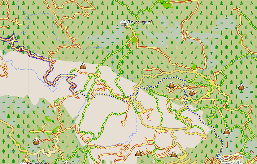
I compared this map with Anavasi Toponavigator v5.32.
The vegetation-types are very nice but TopoNavigator contains much more unpaved roads and trails.
For hiking purposes Anavasi is unbeatable.
Welcome guest, is this your first visit? Click the "Create Account" button now to join.
Results 1 to 10 of 13
Thread: GARMIN NAVITEL MAP OF GREECE Arhcaelogical sites,Trails, Roads, Forest etc. Detailed-Routable.
-
8th January 2012, 02:55 PM #1
 GARMIN NAVITEL MAP OF GREECE Arhcaelogical sites,Trails, Roads, Forest etc. Detailed-Routable.
THE MAP IS FREE FOR GARMIN AND NAVITEL
NEW VERSION UPDATED 2012.01.23


This map is based on data from [Only registered and activated users can see links. ] and is licensed under the [Only registered and activated users can see links. ], and contains data from [Only registered and activated users can see links. ].
ROUTABLE BUT NOT CONTAIN ALL THE ONEWAY STREET DATA
This map is offered in two software/device forms:
For GARMIN software or devices.
Για Navitel software. CAUTION: To work properly the map needs to use Navitel with version 3.2 to 3.5, because newer versions have trouble to open map in nm2 format. This map is exported with GPSMapEdit which can export maps only in this format.
NOTE: multilanguage support is not completed and depends at the data of the map.
For use directly to your device. You can copy directly to the EXTERNAL memory of your device (important: not directly to the device). If your device is old and does not "see" the map rename the file to "gmapsupp.img" (attention Do NOT OVERWRITE AND not delete your own maps and weep! Will not be my fault.).
Map for GARMIN
You’ll find it in two versions:
For use directly from your device. You can copy it directly to the memory card of your device (important: not directly to the device). If your device is old and does not “see” the map, rename the file to “gmapsupp.img” (Attention: do not override or delete your own maps (if there is any with this name!.).
Installation for MapSource / BaseCamp. This is an installation file of the map in MapSource. After installation you can uninstall the map through Add or Remove Programs on Windows Control Panel applet.
Previus Version 2012.01.09:
What’s new:
Contours. This is a separate file, because of its size. Thre are contours every 25 meters (82 feet). At some areas of the map the data are not completed so there are some “holes” there.
Map legend (if you install the map for MapSource/BaseCamp) at the start menu of Windows
There is also a map that contains (only) contours every 25 meters (82 feet). This is a separate file because of its size, and it's available for GARMIN and Navitel.
If you install the map to your PC for MapSource/BaseCamp you'll find a shortcut named "Map Legend" at the folder "Nikos Skouteris" under the Windows start menu, that opens a HTML page containing information about the map elements.
Current version is 2012.01.23
There are a lot of user updates at every version of this map, but is very difficult to record. Basic or big changes will be presented here.
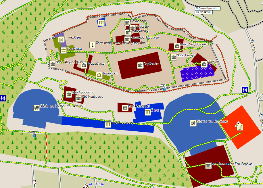
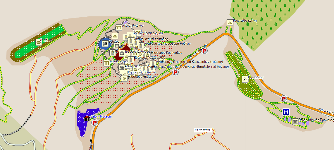
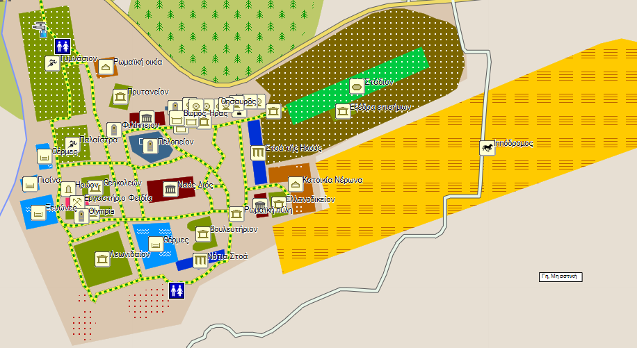
Archeaoligical sites:
Acropolis of Athens, Ancient Agora of Athens, Zeus Temple.
Delphi
Ancient Olympia
Mycenea
Ancient Korinth, Akrokorinth
Amfiaraion
Contours: per 20 meters (65.6 feet), improve, without holes. Smaller file by removing tiles outside Greece. This verion is only for GARMIN. There is another file for Navitel provided by giannis_05. A big THANKS to my friend giannis_05 for his help and his offer to this version.
[Only registered and activated users can see links. ]
[Only registered and activated users can see links. ]
GARMIN DEVICE
[Only registered and activated users can see links. ]
[Only registered and activated users can see links. ]
[Only registered and activated users can see links. ]
[Only registered and activated users can see links. ]
MapSource/BaseCamp:
[Only registered and activated users can see links. ]
[Only registered and activated users can see links. ]
[Only registered and activated users can see links. ]
[Only registered and activated users can see links. ]
[Only registered and activated users can see links. ]
Or Here [Only registered and activated users can see links. ]
Current version 2012.01.23:
[Only registered and activated users can see links. ]
[Only registered and activated users can see links. ]
Map for Navitel
Current Version 2012.01.23
[Only registered and activated users can see links. ]
[Only registered and activated users can see links. ]
[Only registered and activated users can see links. ]
[Only registered and activated users can see links. ]
[Only registered and activated users can see links. ]
or HERE>>> [Only registered and activated users can see links. ]
CONTOURS FROM giannis_05 [Only registered and activated users can see links. ]
[Only registered and activated users can see links. ]
The Map of was created and developed by a friend "Nikolakis the Great", who has spent and offers much of his free time. His aim is to create a map for travelers in Greece, containing details of Archaeological sites, Trails, Beaches, Forests, National Parks etc. items that do not exist in commercial maps. Those of you want, you can freely participate in the enrichment of the map sending more data from the areas you know best and see that something is missing.
CAUTION..... RECOMMENDED to put the maps on the card AND NOT IN THE MEMORY OF THE DEVICE. SO IF ANY PROBLEM presented REMOVE THE CARD AND DEVICE keeps working properly.
For any bug report, suggestion or impairment send e-mail to the address [Only registered and activated users can see links. ]
[Only registered and activated users can see links. ] How to create a map for Garmin devices in GREEK lang ONLY.
[Only registered and activated users can see links. ] details of the Symbols of the MAP in GREEK Lang ONLY
Compatible devices (confirmed):
N�vi 1200
N�vi 205/205w 200/200w
N�vi 760
Oregon x50
Problems:
MapSource-BaseCamp can not route between three or more tiles.
Background device is defective at N�vi 37xx. All other functions work correctly.
Background device is partially defective at N�vi 34xx/ All other functions work correctly.
MobileXT can not route between tiles.
NEW SITES
Mobile PC

3760
MAPSOURCE
CAUTION RECOMMENDED to put the maps on the card AND NOT IN MEMORY OF THE DEVICE. SO IF ANY PROBLEM presented REMOVE THE CARD AND DEVICE keeps working properly.Last edited by pavlitakis; 26th January 2012 at 01:17 PM. Reason: update links


A theory is the meaning we give a certain observed sequence of reality.
The closer the theory meets this reality, the more valid the theory.
-
8th January 2012, 07:33 PM #2MapperoniGuest

-
8th January 2012, 08:24 PM #3

Yes its not better than anavasis, but its real free and in archaeological sites and many places is better. Don t compare the maps on your desktop. Definitely anavasis is more rich. But you can send your tracks and trails from your Area to update the map. It s a creative try and not a topo replacement. But we can import to the map our local details and use a personalized map. Thank you for your time, and you are welcome to send us more info from your area. Like pois and gpx trails.
We invite all to join our group.Last edited by pavlitakis; 8th January 2012 at 08:31 PM.


A theory is the meaning we give a certain observed sequence of reality.
The closer the theory meets this reality, the more valid the theory.
-
8th January 2012, 09:20 PM #4

Nice job,i like the archaeological sites
-
10th January 2012, 09:55 AM #5

Archaeological sites are very poor now, but from the next version you will see the difference. So, keep close if you like.
YES, Anavasi is better but it's not free (350 €) and at some regions is poor. And there is a new map from GeoData called TopoDriveHellas that is cheaper than Anavasi and it's better than this map presented here. At the other hand, [Only registered and activated users can see links. ] is based at user input for its data, therefore is worst, because there are few users that work on this. Take a look at the links [Only registered and activated users can see links. ], [Only registered and activated users can see links. ], [Only registered and activated users can see links. ], [Only registered and activated users can see links. ] (and much more regions of course) and you will find that if users update OSM data, this map (and every map that is based ata OSM data) can be better (not best) for hiking, off-road and touring.
Finally, this is the work of many users ([Only registered and activated users can see links. ]) that spend time from their life and families to make it better, so it worths a lot and a simple thanks means a lot to them.
The map has a separate file now that contains contours (every 25 meters / 82 feet). More information at Map of Greece
This map is the same with the [Only registered and activated users can see links. ].Code:Please Login or Register to see the links
-
10th January 2012, 10:29 AM #6MapperoniGuest

I am fully aware of the effort it takes to create maps like these and I have a lot of respect for those of you that contribute to OSM based maps! I just compared this new map of Greece with some existing ones and shared my opinion, when I am leaving for a hike I like to have the best Topo map on my GPS, for me the best map is not the one with major roads and cities (like City Navigator) but one that contains unpaved roads, trails, contourlines and vegetation-types.
The first free Topo map of Greece (and still one of the best) was made by Peter P (author of Mapdekode). His map also contains all long distance trails (E4, E6 and several O numbers).
It could always be downloaded here but there seems to be a problem lately:
The map is also hosted here:Code:Please Login or Register to see the links
Code:Please Login or Register to see the links
Last edited by Mapperoni; 10th January 2012 at 11:44 AM.
-
10th January 2012, 11:38 AM #7

I used the Peter P map and I agree that is very usefull (speciallly at European and National trails, which, by the way, are not always correct, note the question mark at the name of some parts of them), but at some regions is completely empty (except contours of course).
Anyway, if someone wants to visit an area, has the choise to look which map is suitable for his needs and use it. Now, there is one more option (for Greece) to look.
-
10th January 2012, 11:58 AM #8Junior Member


- Join Date
- Aug 2010
- Location
- Europe
- Age
- 59
- Posts
- 1
- Rep Power
- 0

Good job! I like that also includes areas around the border with neighboring countries.
-
24th January 2012, 11:33 PM #9

-
25th January 2012, 10:54 PM #10Junior Member


- Join Date
- Aug 2009
- Location
- verdg
- Posts
- 4
- Rep Power
- 0

great map for hiking


 Likes:

 Reply With Quote


Bookmarks