Welcome guest, is this your first visit? Click the "Create Account" button now to join.
Results 1 to 2 of 2
-
3rd January 2011, 09:47 PM #1
 CityXplorer Warsaw 2012.30 FID 800
CityXplorer Warsaw 2011.30 (20.11)


•Gives turn-by-turn directions on your compatible Garmin device.
•Includes detailed information, such as turn restrictions, roundabout guidance, speed limits (compatible devices only) and other navigation features.
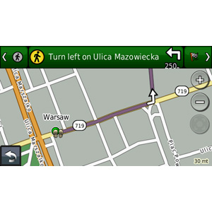
•Provides enhanced pedestrian mode — street directions that use any available forms of public transportation: bus, subway, metrorail, tramway, taxi and more (compatible devices only).
•Provides Lane Assist for compatible devices

About Coverage
Includes detailed road maps and points of interest for the City of Warsaw, Poland, with the ability to navigate using buses, tramway, metro and suburban rail systems where available. Not all cities include all public transit typesą.
Features detailed coverage for the greater Warsaw metro area, including Warsaw Frederic Chopin Airport (WAW), and the 18 boroughs of Warsaw:
◦Mokotów
◦Praga Południe
◦Ursynów
◦Wola
◦Bielany
◦Śródmieście (Stare Miasto, Nowe Miasto)
◦Targówek
◦Bemowo
◦Ochota
◦Białołęka
◦Praga Północ
◦Wawer
◦Żoliborz
◦Ursus
◦Włochy
◦Rembertów
◦Wesoła
◦Wilanów
Coverage also is provided for the cities of Marki, Zielonka and Zabki.
*Coverage area map shows major roads, highways and points of interest coverage only. Enhanced pedestrian navigation coverage varies within the area shown.
ąNot all forms of public transportation are available on all cityXplorer products.
more infos
locked mapCode:Please Login or Register to see the links
FID 2281
unlock with Fast IMG unlocker and add an *.unl file made with notepad: jetmouse kg and PID 2 to enable public transports (on 3790 it wont work)
cityxplorer Warsaw.rar (2,4 MB)
[Only registered and activated users can see links. ]

You have to navigate to get to the good.
Galaxy S5 Kitkat 4.4.2 / Nuvi1200->1250 / Nuvi3790T->34xx / Nuvi 2200 / Nuvi 66 / Oregon 600
-
22nd January 2011, 04:53 PM #2


 Likes:


 Reply With Quote

Bookmarks