In order to save some space you have to create a new "UK-3D Buildings" file every time the CNENTU 20xx.xx is updated.
The created file is about 66 MB so its BIG difference!!!
HOW TO CREATE A SINGLE COUNTRY 3D BUILDINGS FILE
(You need to have Mapsource program and Mapsource version of CN Europe NTU 2015.30 installed on your PC)
1. unlock the original gmap3d.img file
2. on your PC create a folder, ie UK Buildings 3D-2015.30
3. open the unlocked file with Gmaptool
4. use the folder from 2. to split the gmap3d.img file "for Mapsource"
5. Enter UK Buildings 3D-2015.30 as the mapset name and enter a random number for FID (ie 1945) and PID:1
6. Run install.bat from inside UK Buildings 3D-2015.30 folder to install Europe's 3D Buildings on your PC (in Mapsource)
Now the ...tricky part!!!
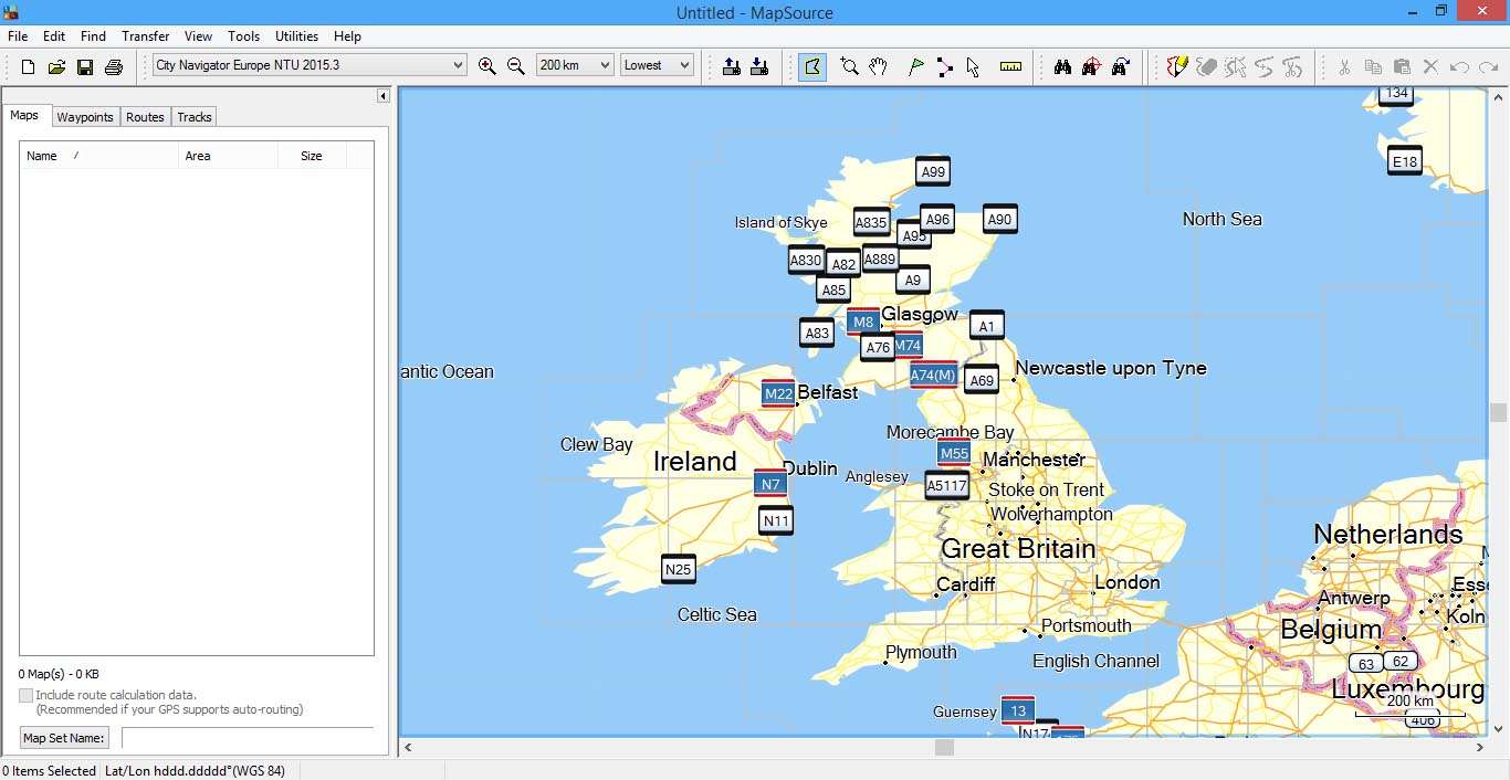
7. open Mapsource, choose CN Europe NTU 2015.30 from you map list and center UK map at zoom level 200Km (so all UK is on your screen)
8. close MapsourceSpoiler: .
9. open Mapsource again and the UK map is now centered on your screen (don't close it)
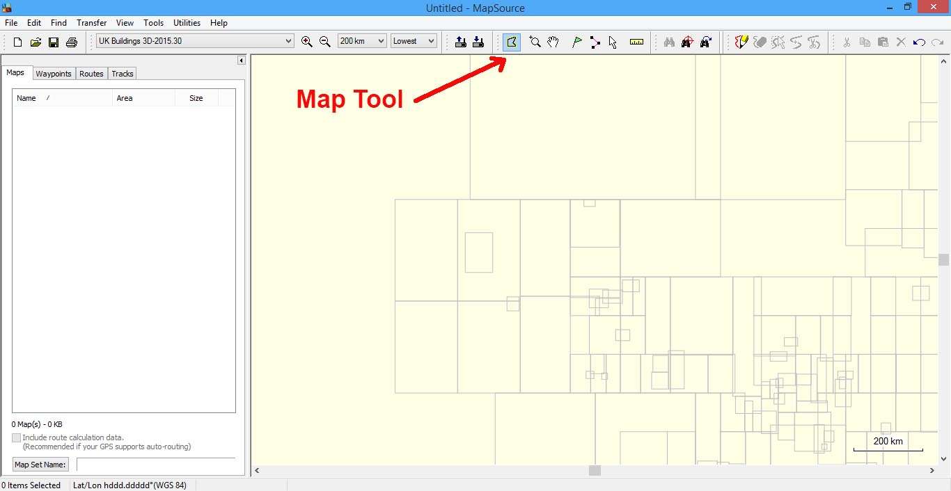
10. open another Mapsource and now choose from your map list the UK Buildings 3D-2015.30 map (you will see nothing on screen-far away zoom level- but your screen is now centered in UK map, like in the first Mapsource)
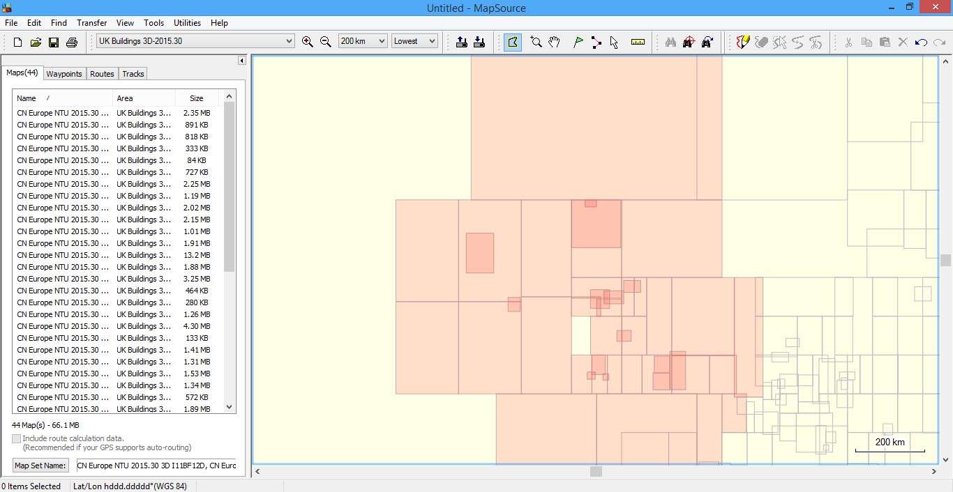
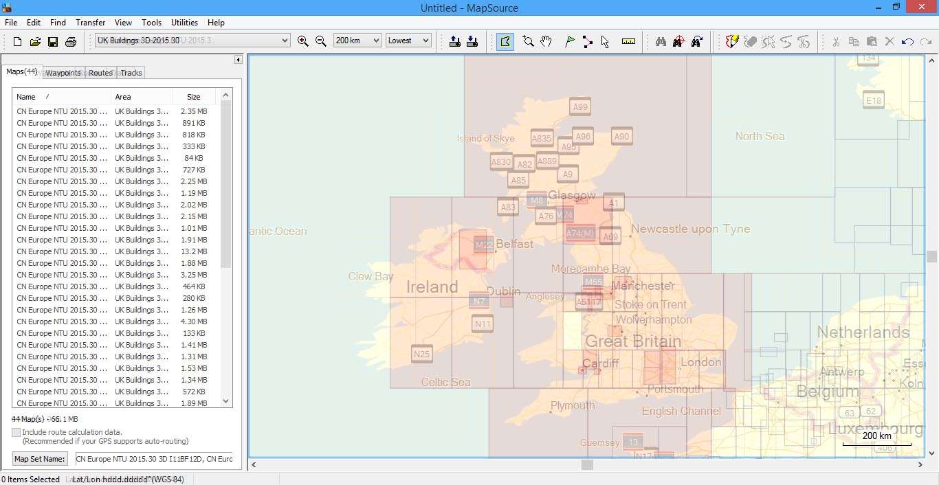
11. in the second Mapsource choose the "Map Tool" and by clicking and dragging the mouse select all the square map tiles that are about UK.Spoiler: .
Use the first Mapsource (with NTU 20.15) as reference to which map tile to select on the second Mapsource.
12. in the second Mapsource change Mapsource's "Map Set Name" from default to: CN Europe NTU 2015.30 3D - (UK)Spoiler: .
13. send the map to your device or PC or sdCard
14. rename the file name from gmapsupp.img to Buildings 3D - UK.img
15. open the Buildings 3D - UK.img with Gmaptool and press "Change" and in Map name filed enter CN Europe NTU 2015.30 3D - (UK) so the map appears with the right name in the myMaps list on your device (map name=mapset name)
Here is the "UK only" 3D Buildings NTU-2015.30 ready to be copied to your device MAP folder:
Code:Please Login or Register to see the links
Welcome guest, is this your first visit? Click the "Create Account" button now to join.
Results 121 to 130 of 172
Hybrid View
-
4th December 2014, 01:26 PM #1


-
4th December 2014, 03:33 PM #2Junior Member


- Join Date
- May 2010
- Location
- st charles
- Posts
- 3
- Rep Power
- 0

Installed on Samsung Galaxy Tab 3 Lite 7.0 (SM-T110) 4.2.2 non-root.
Does not display map correctly. Must be incompatible with GPU.

-
4th December 2014, 07:08 PM #3Member +


- Join Date
- Oct 2012
- Location
- uk
- Posts
- 90
- Rep Power
- 15

@X_trail post #156
Thank you very much for the info.
Out of curiosity will the supplied CN Europe NTU 2015.30 3D file work ok with CN Europe NT 2015.20 map or will I have to create a NT 2015.20 3D file
-
4th December 2014, 09:25 PM #4

Since the 3D Buildings (NTU 2015.30) file is unlocked, it can work OK with any kind of map, not just CN Europe NTU or NT.
It is displayed over any road map in myMaps list!!!
gmap3d.img for NTU is updated 4 times a year but NT is updated only 2 times.
NTU's 3D Buildings is larger than NT's (for UK is 0.4 mb larger).Last edited by Boki; 7th January 2021 at 01:07 PM. Reason: removed unnecessary quote

-
4th December 2014, 09:54 PM #5Member +


- Join Date
- Oct 2012
- Location
- uk
- Posts
- 90
- Rep Power
- 15

Thanks once again, very informative.
Also out of curiosity is it possible to dissect a larger jcv file into separate countries similar to the way you explained with the 3d ones. Nice to learn something new every day.
-
4th December 2014, 10:03 PM #6

Sorry but gmap3d.img is usually locked and version dependant, probably you mean gmapdem.img that is unlocked and not version dependant.
gmap3d.img shows cities buildings pictures on map when you zoom in, DEM map shows 3d terrain shadings.
NT and NTU have different FID and different gmap3d with different FID. All addition files are version dependant because they contain their version FID.
This is the reason you must use CNEU NTU if you want JCV.
NT version doesnt provide a working JCV for SP.
Separate jcv files exist and G Express downloads them when users have lifetime for one region only. You cant build them by yourself, but in CNEU threads usually some users post them along separate regions imgs.
sent with my phone
You have to navigate to get to the good.
Galaxy S5 Kitkat 4.4.2 / Nuvi1200->1250 / Nuvi3790T->34xx / Nuvi 2200 / Nuvi 66 / Oregon 600
-
6th December 2014, 07:43 PM #7Member +


- Join Date
- Oct 2012
- Location
- uk
- Posts
- 90
- Rep Power
- 15

Has anyone actually got the jcv files working on this android 800x480 version.
Im using the ntu map and downloaded regional extras from another thread on this site: UK&RoI ntu unlocked. The contents being
JCV_LaneAssistPortraitFull - D3170160A.jcv
JCV_Nuvi-40,50-Android - D2920150A.jcv
JCV_Split-Screen - D3377140A.jcv
Now Im guessing that only the JCV_Nuvi-40,50-Android is probably compatible with phone and although Ive tried all three files there does not appear to be any difference when exiting highway, complex junctions etc
There was also a g2s file with the bundle which I placed in a g2s folder.
-
6th December 2014, 11:35 PM #8

For SP JCV from Nuvi 40/50 should work just fine. Inside .System folder you must have a JCV folder and in there just copy xxxxxx.jcv file. Always use the jcv file that comes with the version of NTU you have because JCV is one of these files that are version dependant. For example i use only the Greek part of CNEU NTU 2015.30 and for JCV file i use D3589140A.JCV from the same topic you mentioned at the first post, it works in landscape and portrait also.
[Only registered and activated users can see links. ]
-
7th December 2014, 01:51 AM #9

I'm trying to get JCV working for North America map, I use D3478140A.jcv from [Only registered and activated users can see links. ] and put it under <internalStorage>\Garmin\.System\JCV but I don't see any different on map. Is there a way to check to see if it's using the JCV file or turn JCV on/off? My phone is running 4.4.2 so <internalStorage> path is \sdcard0
-
7th December 2014, 03:01 AM #10

Simulate a route to see if junction views will appear.
Set a route for anywhere that you want to check and start the route in simulation mode.
Press on the green bar showing the next turn. This will give you a list of all navigation points. Press the down arrow to see if your route will show some JCV
You have to navigate to get to the good.
Galaxy S5 Kitkat 4.4.2 / Nuvi1200->1250 / Nuvi3790T->34xx / Nuvi 2200 / Nuvi 66 / Oregon 600


 Likes:


 Reply With Quote


Bookmarks