Link is deadReup anyone?
Welcome guest, is this your first visit? Click the "Create Account" button now to join.
Results 1 to 5 of 5
Thread: Garmin LakeMaster Wisconsin v.5
-
21st August 2011, 01:20 AM #1
 Garmin LakeMaster Wisconsin v.5
Garmin LakeMaster Wisconsin v.5
Garmin LakeMaster Wisconsin v.5


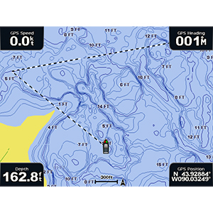
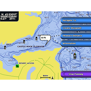
[B]Features detailed coverage of more than 2,500 lakes in Wisconsin, including Balsam, Bone, Deer, Delavan, Manitowish Chain (Alder, Clear, Fawn, Island, Little Star, Manitowish, Rest, Spider, Stone, Wild Rice), Oconomowoc, Pine, Presque Isle, Redstone, Trout, Turtle Flambeau Flowage, Bear Trap, Wapogassett, Pewaukee Lake, Lake Gogebic and Bond Falls Flowage.
Displays rivers, streams, and river and creek channels as well as islands, reefs, points, bays, inlets, access points, boat ramps and aquatic vegetation.
Provides detailed shoreline and depth contours, including up to 1 ft bathymetric contours for many lakes.
Features structure and bottom information created from on-the-water surveys.
Allows you to search by lake or by city.
Includes interstates, highways and general roads to help you get to the water.
Spend the day fishing, boating or just enjoying the water with this mapping product that features highly detailed shoreline data and up to 1 ft depth contours for more than 2,500 lakes, rivers, streams, channels, islands and inlets in Wisconsin.
Code:Please Login or Register to see the links
locked imgCode:Please Login or Register to see the links
FID 2104
unlock with
[Only registered and activated users can see links. ]
LakeMaster Wisconsin.rar (111,1 MB)
This post requires you to click the "LIKE this post" button and hit F5 to read this content.


Last edited by catymag; 30th July 2014 at 12:49 AM. Reason: link replaced

You have to navigate to get to the good.
Galaxy S5 Kitkat 4.4.2 / Nuvi1200->1250 / Nuvi3790T->34xx / Nuvi 2200 / Nuvi 66 / Oregon 600
-
10th December 2013, 01:29 AM #2Junior Member


- Join Date
- Dec 2013
- Location
- Earth
- Posts
- 3
- Rep Power
- 0

-
10th December 2013, 04:33 AM #3
 LakeMaster_Wisconsin.rar
Last edited by Pungente; 9th January 2014 at 10:56 PM.
Recommended to use [Only registered and activated users can see links. ] to unpack my files.
Zero posters won`t have hide links available, please post a [Only registered and activated users can see links. ] to be able to like and unhide links.
↙ LIKE to show your gratitude and unhide links; refresh (hit F5) if necessary.
-
29th July 2014, 06:22 PM #4Junior Member


- Join Date
- Jul 2014
- Location
- Los Angeles
- Posts
- 5
- Rep Power
- 0

Still dead, can someone reupload.
-
30th July 2014, 12:49 AM #5

link replaced in starting post

You have to navigate to get to the good.
Galaxy S5 Kitkat 4.4.2 / Nuvi1200->1250 / Nuvi3790T->34xx / Nuvi 2200 / Nuvi 66 / Oregon 600


 Likes:


 Reply With Quote


Bookmarks