LakeMaster Iowa-Illinois v2
infos
Code:Please Login or Register to see the links
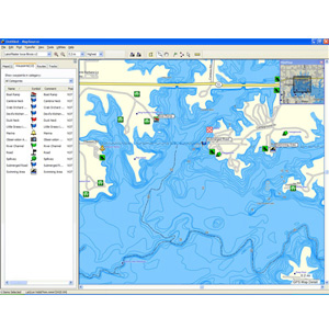
Spend the day fishing, boating or just enjoying the water with this mapping product that features highly detailed shoreline data and up to 1 ft depth contours for more than 300 lakes, rivers, streams, channels, islands and inlets in Iowa and Illinois.
About Coverage
Includes coverage of more than 300 lakes in Iowa and Illinois.
Features detailed coverage of more than 300 lakes in Iowa and Illinois, including Big Creek, Brushy Creek, Clear Lake, Coralville, Five Island Lake, Little Spirit, Lost Island, Okoboji Lakes, Rathbun, Saylorville, Silver, Spirit, Storm, Carlyle, Chain-O-Lakes, Illinois River, Kincaid, Matoon, Newton, Rend and Shelbyville.
Displays rivers, streams, and river and creek channels as well as islands, reefs, points, bays, inlets, access points, boat ramps and aquatic vegetation.
Provides detailed shorelines and depth contours, including up to 1 ft bathymetric contours for many lakes.
Features structure and bottom information created from on-the-water surveys.
Allows you to search by lake or by city.
Includes interstates, highways and general roads to help you get to the water.
locked .img
PID 1, FID 443, region 1,6
Code:Please Login or Register to see the links
LakeMaster_Iowa_Illinois.rar (70,2 MB)
[Only registered and activated users can see links. ]
Welcome guest, is this your first visit? Click the "Create Account" button now to join.
Results 1 to 4 of 4
Hybrid View
-
6th September 2011, 11:29 PM #1
 Garmin LakeMaster Iowa-Illinois v2
Last edited by catymag; 10th December 2013 at 03:06 AM. Reason: link renewed

You have to navigate to get to the good.
Galaxy S5 Kitkat 4.4.2 / Nuvi1200->1250 / Nuvi3790T->34xx / Nuvi 2200 / Nuvi 66 / Oregon 600
-
10th December 2013, 01:30 AM #2Junior Member


- Join Date
- Dec 2013
- Location
- Earth
- Posts
- 3
- Rep Power
- 0

Link Dead. Reupload please
-
10th December 2013, 04:16 AM #3

Last edited by Pungente; 10th December 2013 at 06:52 AM.
Recommended to use [Only registered and activated users can see links. ] to unpack my files.
Zero posters won`t have hide links available, please post a [Only registered and activated users can see links. ] to be able to like and unhide links.
↙ LIKE to show your gratitude and unhide links; refresh (hit F5) if necessary.
-
10th December 2013, 04:45 AM #4

I can confirm it works too:

The link is good, try again arnesr.'Thanking Posts' are banned. To thank someone, and/or to see hidden links and content, use the [Only registered and activated users can see links. ] button below left of the helpful post then refresh your browser [F5 key]. 'Thanking Posts' are banned.
Please don't spam. Posts serving no purpose other than to thank or to ask about hidden links are trashed or deleted, it's GPSPower's policy. Please don't spam.
[Only registered and activated users can see links. ] should make their first post as a new Intro Thread in [Only registered and activated users can see links. ].


 Likes:


 Reply With Quote


Bookmarks