It's not a genuine MapSource install.
Installation files made by using gMapTool and cGPSmapper. Search button disabled in MapSource as a consequence.
Welcome guest, is this your first visit? Click the "Create Account" button now to join.
Results 1 to 10 of 33
-
10th April 2011, 02:55 PM #1
 Friluftskartan TOPO Sweden Pro v2 Gotaland ( Mapsource)
Friluftskartan TOPO Sweden Pro v2 G�taland
( Mapsource)

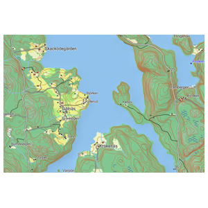
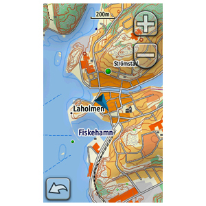
Preparing for a great outdoor adventure? TOPO Sweden - G�taland provides detailed topographic coverage in the G�taland region of Sweden with searchable points of interest and 3-D elevation data for compatible Garmin devices. This highly detailed topographic product is generated from a resolution of 1:50,000, and 1:100,000 over the Swedish part of the Scandinavian mountains.
Friluftskartan Pro is intended for use in Europe. All content and map data is available in Swedish.
About Coverage
Includes digital topographic maps for the G�taland region of Sweden

â¢Integrates data from Lantm�teriet at a scale of 1:50,000 and 1:100,000 to provide the latest generation of vectorised topographic maps that are compatible with Garmin outdoor devices.
â¢Includes updated map data such as roads, paths, STF:s Hostels and mountain huts, lakes, elevation contours, rivers, vegetation, elevation shading, points of interest (POIs) from Teleatlas and more.
â¢Provides searchable POIs including restaurants, landmarks and mountain shelters.
infos
locked Gmaptool Mapsource installationCode:Please Login or Register to see the links
FID 2057
[Only registered and activated users can see links. ]
credits to a friend who provided it- thanks
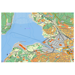
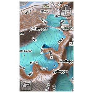
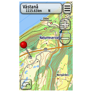
Genuine GMAP-directory for TOPO Sweden Pro v2 - G�taland: [Only registered and activated users can see links. ]Last edited by catymag; 22nd April 2011 at 01:54 AM. Reason: added detail

You have to navigate to get to the good.
Galaxy S5 Kitkat 4.4.2 / Nuvi1200->1250 / Nuvi3790T->34xx / Nuvi 2200 / Nuvi 66 / Oregon 600
-
10th April 2011, 06:14 PM #2BallebarGuest

-
10th April 2011, 06:45 PM #3
-
10th April 2011, 08:38 PM #4Junior Member


- Join Date
- Sep 2010
- Posts
- 5
- Rep Power
- 0

When running the .bat file I get
--
ERROR: Access is denied.
ERROR: Access is denied.
ERROR: Access is denied.
ERROR: Access is denied.
ERROR: Access is denied.
--
Running Win7 In vmware...
Ideas?
Fixed it.. Run the bat files as admin, worked.
Problem 2:
Well, been trying to get it to become vissble in Mapsoure, But for some reason I don't manage to get it to be so. Maybe its me who is doing something wrong?!
I have unlocked the map, and it says "Unlocked", but I cant see it in Mapsource anywhere. Anyone who got it to work?
Ideas?
edit again: I found the map. There was two "map patches", where One was the correct map and the other one was empty.Last edited by jlw; 10th April 2011 at 09:55 PM.
-
13th April 2011, 10:09 AM #5Member


- Join Date
- Feb 2010
- Location
- Sweden
- Posts
- 26
- Rep Power
- 16

It would be nice if we can got the untouched .img file. Then we can open it in Basecamp or in a GPS
-
13th April 2011, 11:10 AM #6
-
13th April 2011, 11:54 AM #7Member


- Join Date
- Feb 2010
- Location
- Sweden
- Posts
- 26
- Rep Power
- 16

I joined the files in Gmaptool and i can open the img in Basecamp, but i am not sure if there will miss any functionality.
-
13th April 2011, 01:20 PM #8

Since it is a topo map there is not so much need for more functionality. I use it for mountainbiking and walking and it is ok to make routes or tracks in Mapsource and then transfer the routes to the gps. What are you missing? The "search nearest" works in Mapsource but not the "search" (leftmost icon) for some reason.
For routing I use the CityNavigator behind the topo map which works fine.
Why do you use Basecamp? It is terribly slow with older computers ;-)
-
13th April 2011, 02:45 PM #9Member


- Join Date
- Feb 2010
- Location
- Sweden
- Posts
- 26
- Rep Power
- 16

I like Basecamp i have P4 3.2 Ghz computer, 2 Gb memory with Win7 and it is no problem with speed. In Basecamp the search function works rather good. I am interested in the untouched img just for it is untouched.
One thing who dosent work is to print the map from converted img loaded from usb.
-
13th April 2011, 06:53 PM #10Junior Member


- Join Date
- Feb 2011
- Location
- Germany
- Age
- 53
- Posts
- 3
- Rep Power
- 0

Can someone upload the whole topo sweden pro v2 in a unlocked gmapsupp image?
  Advertissements
Â
Â


 Likes:


 Reply With Quote
 or [Only registered and activated users can see links.


Bookmarks