Welcome guest, is this your first visit? Click the "Create Account" button now to join.
Results 1 to 6 of 6
-
21st October 2015, 04:52 PM #1Banned


- Join Date
- Jul 2013
- Location
- https://t.me/pump_upp
- Posts
- 26
- Rep Power
- 0
 City Navigator East&West Africa NT 2016.20
City Navigator Eastern Africa NT 2016.20
Navigate the streets with confidence. This product provides detailed road maps and points of interest for your device, so you can navigate with exact, turn-by-turn directions to any address or intersection.
- Includes more than 319,000 miles (513,381 km) of roads, including motorways, national and regional thoroughfares and local roads, in Eastern Africa.
- Displays thousands of points of interest throughout the continent, including restaurants, lodging, petrol/gasoline stations, attractions and railways.
- Gives turn-by-turn directions on compatible devices.
- Speaks street names (example: "Turn right on Main Street").
- Includes navigational features, such as turn restrictions, roundabout guidance and speed categories.
- Contains traffic data for compatible devices that use traffic receivers.
FID: 3896
Original Image East Africa:
This post requires you to click the "LIKE this post" button and hit F5 to read this content.
3D East Africa:
This post requires you to click the "LIKE this post" button and hit F5 to read this content.
G2S East Africa:
This post requires you to click the "LIKE this post" button and hit F5 to read this content.
SID East Africa:
This post requires you to click the "LIKE this post" button and hit F5 to read this content.
POI: Tracks4AfricaEastAfrica_2016_20.gpi
This post requires you to click the "LIKE this post" button and hit F5 to read this content.

Last edited by Paveli; 21st October 2015 at 06:59 PM.
-
21st October 2015, 05:45 PM #2Banned


- Join Date
- Jul 2013
- Location
- https://t.me/pump_upp
- Posts
- 26
- Rep Power
- 0

Last edited by Paveli; 21st October 2015 at 06:58 PM.
-
22nd October 2015, 02:27 PM #3

Download Instructions:
Spoiler: download
inside
unlocked image file
unlocked 3d file
poi file
Hoster
filefactory
share-online.biz
-
24th October 2015, 12:08 AM #4

City Navigator East & West Africa NT 2016.20
West part:
Download CN East & West Africa NT 2016.20 -7 RAR volumes, unpacked size 1.396.604.928 bytesCode:Please Login or Register to see the links
This post requires you to click the "LIKE this post" button and hit F5 to read this content.
East part:
East Africa 16.20_gmapprom - 4 RAR volumes, unpacked size 737.918.976 bytesCode:Please Login or Register to see the links
Download:
This post requires you to click the "LIKE this post" button and hit F5 to read this content.
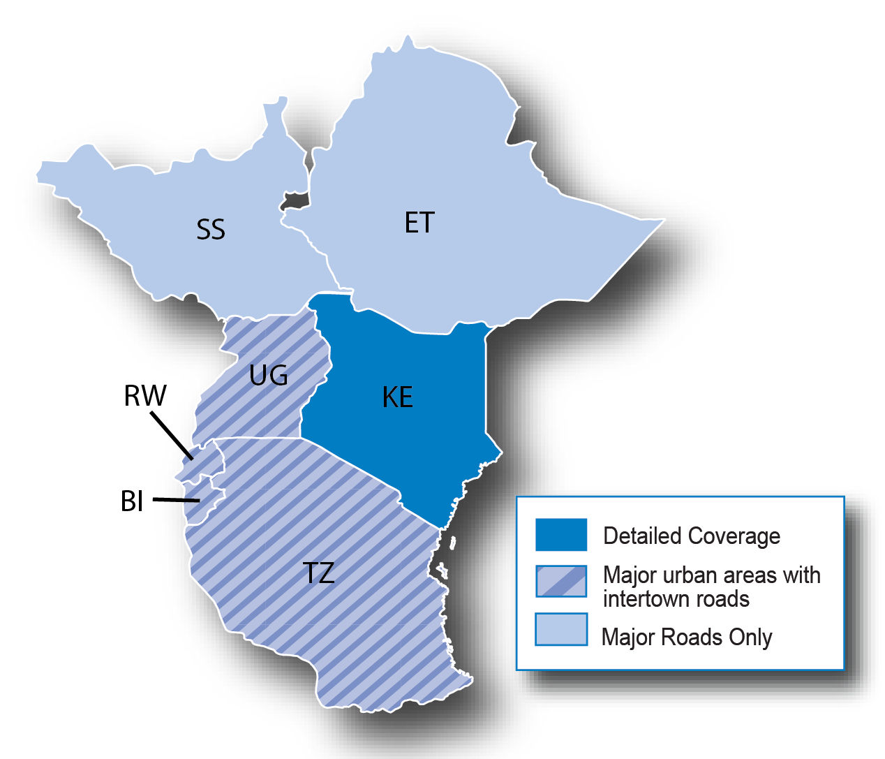
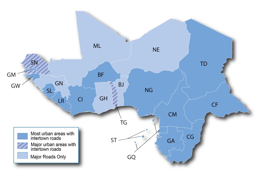
Coverage:

°°°°°°°°°°°°°°°°°°°°°°°°°°°°°°°°°°°°°°°°°°°°°°°°°°°°°°°°°°°°°°°°°°°°°°°°°°°°°°°°°°°°°°°°°°°°°°°°°°°°°°°°°°°°°°
East Africa only gmap3d:
This post requires you to click the "LIKE this post" button and hit F5 to read this content.
EastAfrica SID_FastRouting-34xx-25xx
EastAfrica SID_InstaSearch-34xx-25xx
Tracks4Africa EastAfrica 2016.20.GPI
This post requires you to click the "LIKE this post" button and hit F5 to read this content.Last edited by catymag; 12th January 2016 at 12:04 AM. Reason: new links

You have to navigate to get to the good.
Galaxy S5 Kitkat 4.4.2 / Nuvi1200->1250 / Nuvi3790T->34xx / Nuvi 2200 / Nuvi 66 / Oregon 600
-
17th January 2016, 03:18 PM #5Member


- Join Date
- Apr 2013
- Location
- Montenegro
- Age
- 39
- Posts
- 26
- Rep Power
- 17
-
17th January 2016, 03:32 PM #6

download East part too, map name is CN East & West Africa NT, but it's splitted in 2 parts, West and East
Last edited by navifan2; 17th January 2016 at 03:35 PM.


 Likes:
 Reply With Quote


Bookmarks