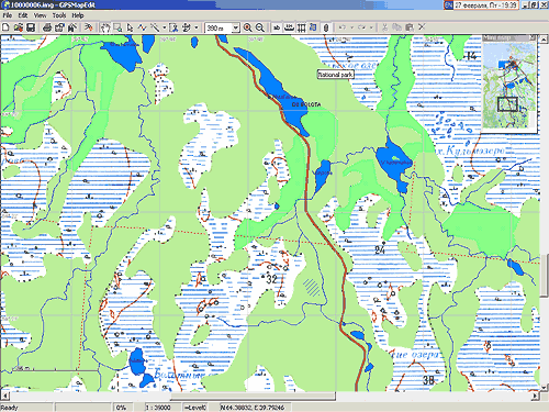
GPSMapEdit 1.0 (update 68.1)
(August 21st, 2011)
Download [Only registered and activated users can see links. ] (2279 K).
Download [Only registered and activated users can see links. ] (2204 K).
- New feature: The attributes of Polish format "Label2" and "Label3" are supported for maps with type set "Garmin". The attributes are loadable also from Garmin IMG format.
- Enhancement: GUI localization for Japanese (beta-version based on automatic translation) is added. The localization for Persian is enhanced (thanks to Reza Amyari). Transliteration tables for Japanese kanas and for Persian to Latin is added.
Names of Garmin types in Polish language are fixed (thanks to Alf/red/).- Enhancement: Confirmation message is provided before deleting objects (thanks to Sergey Shetsko).
The confirmation may be turned off using the menu item 'Tools | Options...', "Edit" tab, checkbox "Confirm deleting objects".- Enhancement: In the window "Object Properties", the tab "Comment" is added; the field "Comment" is removed from the "Properties" tab.
- Enhancement: In the window "Object Properties", the tab "Extras" is enhanced (adding, removing and editing of separate attributes is now supported).
- Enhancement: In the window "Map Properties", the tab "Extras" is enhanced.
- Fix: In the tool "Create Object | Polygon" and "Polygon: Strip", inserting a last point of contour now does not require cursor shifting (thanks to sersenk).
- Enhancement: In the tool "Select Objects", sticking to neighbours is now applied to dragged POIs and bookmarks (thanks to Vladimir).
- Enhancement: In the GPS protocol NMEA-0183, the sentences with the prefix "GN" are supported (the mixed mode GLONASS + GPS) (thanks to Alexey Rodionov).
- Enhancement: Numbering along roads may be edited for maps with type set "Navitel". Being exported to .NM2 format, these numbers are automatically converted to hidden addressable points with type 0x2800.
- Fix: Crash while exporting of some of maps into the format NM2 for Navitel 3.2.6 (thanks to Igor A. Sichev, autostavrroute, Albert Semenov).
- Fix: Crash while loading some of files "gmapsup2.img" (thanks to Dmitry Kurochka).
- Fix: Crash while creation of new polygons due to out of memory (thanks to Albert Semenov, Monstria).
more infos
Instructions and tutorials:Code:Please Login or Register to see the links
The last release 76.7 [Only registered and activated users can see links. ]Code:Please Login or Register to see the links
Welcome guest, is this your first visit? Click the "Create Account" button now to join.
Results 1 to 10 of 58
Threaded View
-
21st August 2011, 10:13 PM #1
 Geopainting GPSMapEdit up to 2.1 (update 78.8)
Last edited by Roger; 22nd February 2013 at 06:52 PM. Reason: join link the last release 76.7

You have to navigate to get to the good.
Galaxy S5 Kitkat 4.4.2 / Nuvi1200->1250 / Nuvi3790T->34xx / Nuvi 2200 / Nuvi 66 / Oregon 600


 Likes:


 Reply With Quote

Bookmarks