GPS vector map for Morocco
...and Western Sahara
The Map
This page is about a free vector-map of Morocco and Western Sahara for handheld GPS-recievers, e.g. the Garmin eTrex series. The map is provided as-is, no warrantys whatsoever are given
Garmin MapSource format
Download Garmin-format, [Only registered and activated users can see links. ](21.DEC.2007, 25.851kB)
Download Garmin-format, [Only registered and activated users can see links. ] (21.DEC.2007, 3.696kB)
Download [Only registered and activated users can see links. ] - Topo Overlay (21.DEC.2007, 22.503kB)
You will need Garmin MapSource to use this version. Also see the [Only registered and activated users can see links. ]on how to use custom maps with MapSource.
For easy installation of both parts of the map, try the self-installing .exe version. To update an existing installation, it is sufficient to download the "road map" or "topo overlay" parts as needed and unpack them to your installation directory, replacing the old files (saves your and my bandwidth!).
[Only registered and activated users can see links. ]
Garmin-format, Roadtrip for Apple · 25.49 MB · 21.12.2007
Status of the map
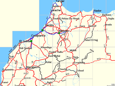
The map tiles now cover whole Morocco and Western Sahara from Oujida to Nouadibou and from Figuig to Essaouira
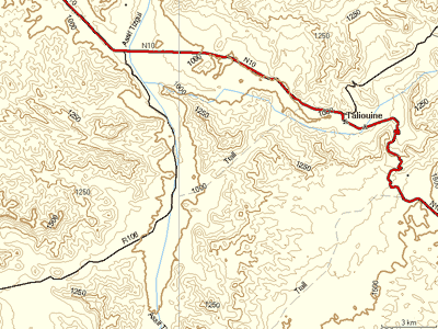
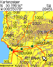
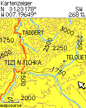
50m contour lines are included in the "topo overlay", generated from SRTM version 2 data
"Major highways" (blue in Mapsource) should be four laned roads or broader
"Other Highway roads" (red in Mapsource) should be asphalted
"Arterial roads" (thick black lines) are probably asphalted, otherwise more or less easy to travel
"Collector roads" (thin black lines) are rather difficult tracks
"Unpaved roads" (dashed lines) are off-road connectors
Most of the roads are measured with GPS accuracy. On higher zoom levels, additional uncategorized, non GPS measured roads from VMAP0 pop up.
Road numbers and names are taken from the Michelin paper map
T4A maps v.810.03 Garmin Morocco & Western Sahara 10.2008 mapsource version
[Only registered and activated users can see links. ]
Welcome guest, is this your first visit? Click the "Create Account" button now to join.
Results 1 to 10 of 14
-
20th April 2009, 12:51 PM #1
 Garmin vector mapTopo Morocco+ fas Morocco map+topo
Hi
I donīt know if anyone has posted before.
This page is about a free vector-map of Morocco and Western Sahara for Garmin receivers. It is topo unroutable.
island-olaf.de/travel/marokko/gps.html
(As I canīt post links just add the www)
Regards
Noksan
-
20th April 2009, 03:55 PM #2

Last edited by catymag; 10th January 2010 at 05:24 PM.

You have to navigate to get to the good.
Galaxy S5 Kitkat 4.4.2 / Nuvi1200->1250 / Nuvi3790T->34xx / Nuvi 2200 / Nuvi 66 / Oregon 600
-
22nd August 2009, 10:17 PM #3adamturkeyGuest
-
23rd October 2009, 05:27 PM #4philfreeGuest

I thought I had finally found the map I was looking for but the link is dead aarrgh Can you please reupload
Many thanks
Phil
-
16th November 2009, 03:03 AM #5
-
22nd April 2011, 08:49 AM #6gitanGuest

sadly I must say maroc-topo-20071221 has no autorouting in Mapsource.....
Am I wrong?
-
22nd April 2011, 11:58 AM #7


You have to navigate to get to the good.
Galaxy S5 Kitkat 4.4.2 / Nuvi1200->1250 / Nuvi3790T->34xx / Nuvi 2200 / Nuvi 66 / Oregon 600
-
25th November 2011, 12:39 PM #8

just back from Morocco I must say that, though not routable, the free map is the best for offroad navigation and more detailed than the Garmin map, especially in the far south.
I had both maps on different Garmins running.
The Garmin map ist stunningly detailed in the cities and allows even precise navigation through (and out of) the Marrakech souk. On the other hand there are some bugs with road navigation: obviously a number of junctions are not linked properly so the Garmin won't navigate over it...
-
18th May 2012, 04:45 PM #9

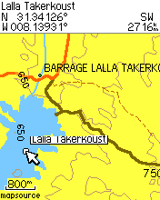
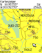
without obtained permission from the author I modified the typ file a bit to get roads, pistes, tracks and borderline better displayed. The map then looks like this:

I'll send the typ file to Catymag to upload it for interested users.
Installation in Mapsource is easy: just search the file 3567.typ on your PC, backup the original file (!) and then replace it with the modified 3567.typ - restart Mapsource
-
18th May 2012, 05:08 PM #10


 Likes:

 Reply With Quote




Bookmarks