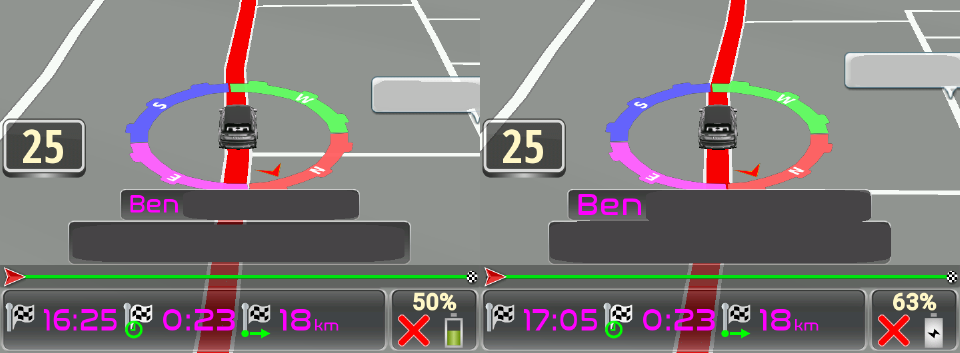
In the sys file in the [rawdisplay] section, by removing the semicolon in front of dpi, you will choose the appropriate resolutions
[rawdisplay]
driver="gles_2_0_android"
screen_xy="auto"
;base_dpi=240
;dpi=120
;dpi=160
dpi=240
;dpi=320
;dpi=480
;dpi=640
you have at least 240 as you can see
Welcome guest, is this your first visit? Click the "Create Account" button now to join.
Results 1 to 9 of 9
-
8th November 2021, 01:34 PM #1Member +


- Join Date
- Apr 2017
- Location
- Turkey
- Posts
- 30
- Rep Power
- 0
 İgo Nextgen (Pongo Skin) Text Size Increase
Hello.
As can be seen in the video, I use Igo Nextgen version 9.18.27.736574, navigation with pongo skin in my vehicle.
Due to the design of the vehicle, the screen stays too far inside. Icons and city name in the navigation footer are too small.
Is it possible to enlarge the icons and information bar a bit?
Spoiler: +Last edited by Andrey Form; 8th November 2021 at 01:54 PM.
-
8th November 2021, 01:51 PM #2Member +


- Join Date
- Mar 2017
- Location
- Poland
- Posts
- 40
- Rep Power
- 36


-
8th November 2021, 02:07 PM #3Member +


- Join Date
- Apr 2017
- Location
- Turkey
- Posts
- 30
- Rep Power
- 0
-
8th November 2021, 02:51 PM #4Master


- Join Date
- Nov 2017
- Location
- europa
- Posts
- 125
- Rep Power
- 245

changing the dpi is like putting a magnifying glass in front of the gps screen it does not solve the changes in details.
everything concerning the appearance of the data linked to the display on the map has a good chance of being configured mainly in the two files default.vis and overview.vis of the data.zip, look for the word 'font' in these files
Spoiler: code
try modifications in the different corresponding sections according to each zoom level with altitude (2D or 3D views can have independent settings), remember that some UXs may contain a default.vis and that in this case any modification to that of the data.zip would have no effect on the screen
[Label600m-4300m]
area=0,1,2
poi="Settlement.class1", "defaultbd", "label_settlements", 14,"settlements",1
poi="Settlement.class2", "defaultbd", "label_settlements", 13,"settlements",2
poi="Settlement.class3", "defaultbd", "label_settlements", 12,"settlements",2
there are certainly other locations in various files that influence the appearance like the coloring in the color.ini.
keep in mind that what concerns the display of information in labels or buttons in the form of layers over the map (in xml or css files), and information in the map (as in vis files ) are managed independently but can also be crossed in ini files or sys.txtLast edited by lunapark; 8th November 2021 at 03:13 PM.
-
8th November 2021, 05:46 PM #5
 City Name size
I have another proposal: the coding of the City Name is located in:
the_skin_by_pongo.zip\ui_nextgen\common\ui\the_skin_by_pongo.css
See line 46 (For the Skin Pongo of 12 November 2019)
Spoiler: Original code
ROADSHIELDEDTEXT.current_city......
fontsize:fontsize_current_city
We can't touch : "fontsize_current_city " because it is already used in other coding
To modify only the City name coding I propose
Spoiler: Code Modify
The number "8" can be increased or decreased
Here is the comparative result
Spoiler: Pics
Here I made the modification on the Skin Pongo of 12 November 2019
Spoiler: Hide
RegardsLast edited by LouBouha; 10th November 2021 at 07:57 PM.
GPS: TomTom ONE
Smartphone: THL T11 Android 4.2.2 Resolution 720x1280
Sygic 14.3.4 IGO Primo 9.6.29.636868 Skins : Doupas V9.0h , Dimka/Frontzosd
-
10th November 2021, 09:29 AM #6Member +


- Join Date
- Apr 2017
- Location
- Turkey
- Posts
- 30
- Rep Power
- 0

Hello @LouBouha
The plugin you added works without any problems, at least in the application. Thanks.
However, when I increase the number 8 in thecode block (10,12,14 ... ) the application closes without an error when opening.Code:Please Login or Register to see the links
I used 7zip (version 21.01) and winrar (version 6.02) for packaging. In both applications, the result did not change.
-
10th November 2021, 10:30 AM #7

You have to use WinRAR version less than 4, I use version 3.93. Or Total Commander APK
Tested with : 11 OK
RegardsLast edited by LouBouha; 10th November 2021 at 10:38 AM.
GPS: TomTom ONE
Smartphone: THL T11 Android 4.2.2 Resolution 720x1280
Sygic 14.3.4 IGO Primo 9.6.29.636868 Skins : Doupas V9.0h , Dimka/Frontzosd
-
10th November 2021, 10:55 AM #8Member +


- Join Date
- Apr 2017
- Location
- Turkey
- Posts
- 30
- Rep Power
- 0

Thank you @LouBouha.
The problem was solved with winrar 3.93 version.
-
27th January 2024, 01:19 PM #9Member


- Join Date
- Oct 2015
- Location
- Brazil
- Posts
- 12
- Rep Power
- 0

Good morning.
Following the instructions above, I was able to increase the size of the city letters. (yellow arrow, 1).
I would appreciate it if you could help me enlarge the letters in the neighborhood (red arrow,2)
Please, click on picture above to see completly
[Only registered and activated users can see links. ]Last edited by jjsxjjsx; 27th January 2024 at 09:22 PM. Reason: Add text to know


 Likes:
 Reply With Quote


Bookmarks