Someone created a layer of Indonesian ocean floor in IMG format. it can be combined with regular Indonesian maps, to see the ocean depth.
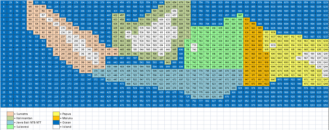
He said the original data came from [Only registered and activated users can see links. ]. the result is a 1250 tiles covering Indonesia and surrounding areas, grouped into 8 rar files. and here is the tiles layout:
the numbers represent the last four digit of the files.
Short story of his work is [Only registered and activated users can see links. ], it is better to read it first before downloading all 8 rar files [Only registered and activated users can see links. ]. here is one of his picture (combined with [Only registered and activated users can see links. ] map):
enjoy.
Welcome guest, is this your first visit? Click the "Create Account" button now to join.
Results 1 to 3 of 3
Threaded View
-
24th September 2011, 04:40 AM #1Junior Member


- Join Date
- Nov 2010
- Location
- somewhere
- Posts
- 9
- Rep Power
- 0
 Indonesian Bathymetric layer in IMG format
Last edited by Ballebar; 22nd April 2012 at 03:03 PM. Reason: Added IMG-markup for attached pictures.


 Likes:


 Reply With Quote

Bookmarks