Torrent:
Code:Please Login or Register to see the links
Welcome guest, is this your first visit? Click the "Create Account" button now to join.
Results 1 to 2 of 2
-
23rd August 2012, 11:43 PM #1
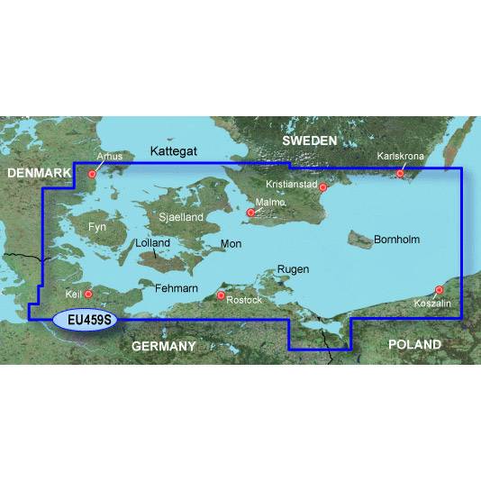
 Garmin Bluechart G2 - HXEU459S - Arhus - Kiel - Koszalin 2012.5 v.14.00
Garmin Bluechart G2 - Hxeu459s - Arhus - Kiel - Koszalin

Features
Coverage
Swedish coast: from Hoganas to Karlskrona, including Malmö. Danish, German, and Polish coasts: from Århus to Koszalin, including Sjælland, Fyn, Møn, Falster, Lolland, Langeland and Fehmarn.
About BlueChart g2 Maps
Get a new perspective on navigation with BlueChart g2 marine cartography. This newly designed map data provides even more detail, dimension and graphical sophistication to a well-proven benchmark of marine navigation.
Featuring crisp labeling and an overall smoother presentation on your chartplotter display, the new generation of BlueChart g2 has numerous improvements to assist in marine navigation. In addition to the basic charts, tidal stations, currents, depth contours, IALA symbols, and included fishing charts, BlueChart g2 offers improved transitioning between zoom levels and more seamless continuity across chart boundaries.
BlueChart g2 also adds Safety Depth settings to let users select up to five values for specific depth contour intervals. And the fishing charts are designed to emphasize bathymetric contours with less visual clutter on the display. There’s also a choice of standard 2D direct overhead or 3D “over the bow” map perspective views to make chart reading and orientation easier.
Realistic navigation features showing everything from shaded depth contours and coastlines to spot soundings, navaids, port plans, wrecks, obstructions, intertidal zones, restricted areas, IALA symbols and more
Smooth display presentation including seamless transitioning between zoom levels and more continuity across chart boundaries
Safety Depth settings lets you select up to five values for specific depth contour intervals
Fishing charts to focus on bathymetric contours with less clutter on the display
Choice of standard 2D direct overhead or 3D “over the bow” map perspective to make chart reading and orientation easier
[hide]
[Only registered and activated users can see links. ]
[Only registered and activated users can see links. ]
[/hide]
Code:Please Login or Register to see the links
-
25th August 2012, 05:16 PM #2
 Torrent


 Likes:


 Reply With Quote


Bookmarks